Trails Attractions - Holiday Gold Coast

ATTRACTIONS TRAILS
Hawkings Point Track Logo and Images

Hawkings Point Track

Hawkings Point Lookout, Magnetic Island QLD 4819
Starting at the eastern end of Picnic Street in Picnic Bay, follow a track that will lead you to the saddle between Rocky Bay and Picnic Bay. Here, you will have a decent view over Rocky Bay. From here, you can even scramble down to Rocky Bay. Otherwise, the track then winds to the top of a large boulder, offering views over toward Picnic, Nelly, and Geoffrey Bays and back toward Townsville. This is Hawkings Point Lookout. One of the best places to watch sunrise and sunset on Magnetic Island....
Curtis Falls track, Tamborine National Park Logo and Images

Curtis Falls track, Tamborine National Park

Dapsang Drive car park, Tamborine QLD 4270
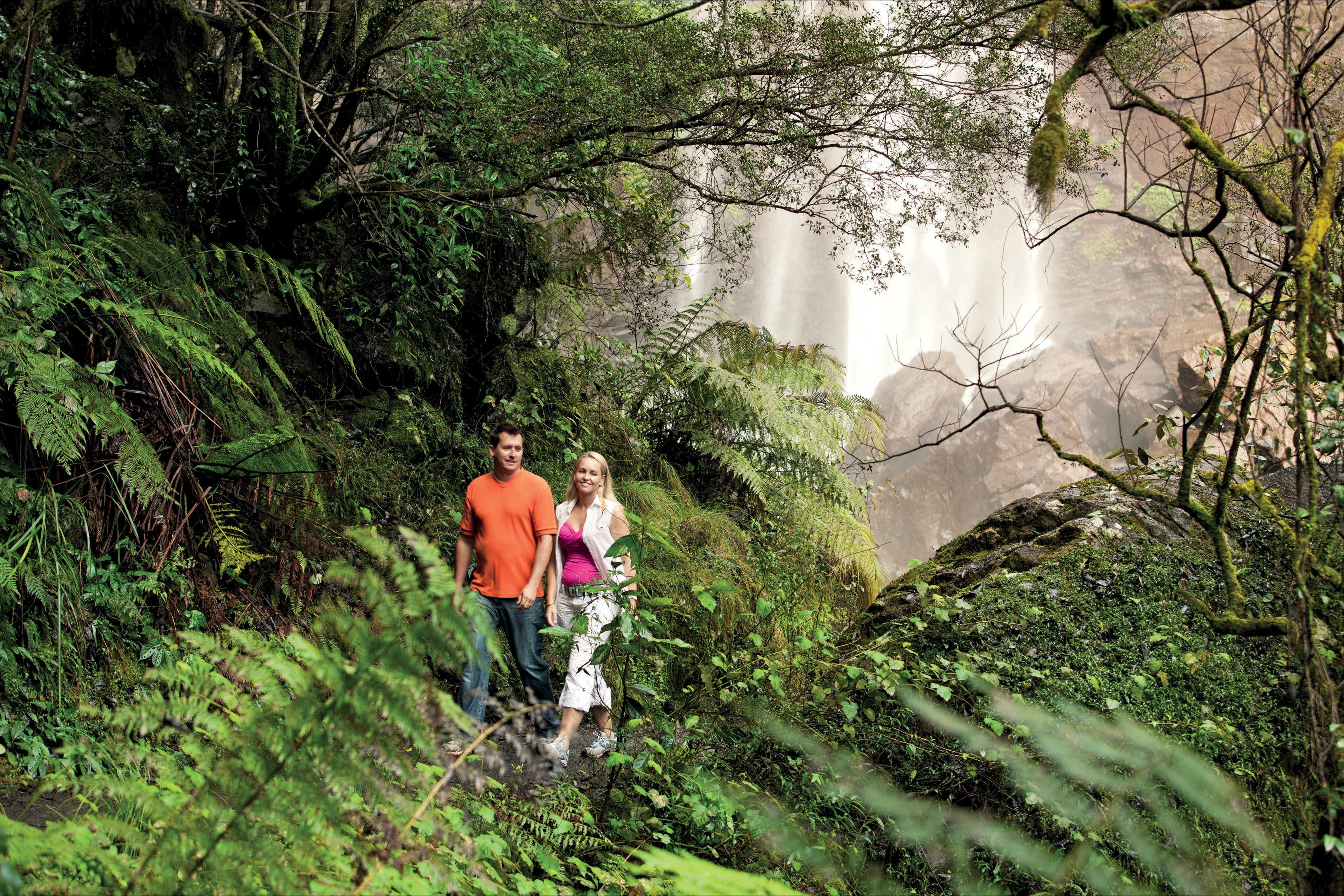
Enjoy an enchanting walk through wet eucalypt forest beneath towering flooded gums and into cool and lush rainforest. Look for the beautiful crows nest and staghorn ferns in the canopy, and stop to marvel at the intricate strangler fig. The first view of the falls will take your breath away. Depending on the season, a raging torrent or gentle curtain of water tumbles over huge basalt columns to the pool below. The columns are the legacy of the region's rich volcanic history. Look for basking turtles on fallen logs and see fish and eels in the rock pool. If you’re lucky you might see the local platypus. At night, look for glow-worms in the surrounding cliffs. Note that access to the Curtis Falls rock pool and surrounding area is not permitted—it is a restricted access area for visitor safety and protection of glow-worm and platypus populations....
Purling Brook Falls circuit, Springbrook National Park Logo and Images

Purling Brook Falls circuit, Springbrook National Park

Forestry Road, Springbrook QLD 4213
Spectacular waterfalls and cool ancient forests await you in the beautiful World Heritage-listed Gondwana rainforest of Springbrook National Park. On this beautiful circuit walk, in the Springbrook Plateau section of the park, pass through open eucalypt forest of New England ash, before descending into the gorge to view the falls from below. After crossing the suspension bridge a steady climb through forest brings the walker back to the picnic area. Look for ancient lepidozamias, colourful hakeas and dazzling wildflowers along the way to this stunning waterfall. There are 265 steps on this walk and it's easier to walk in a clockwise direction. For visitor safety Purling Brook Falls has a restricted access area at the top and base of the waterfall. There are sheer cliffs and waterfalls so keep to the track. If you've got time, detour on the Warringa Pool track, which leads downstream from the base of the falls; you'll add another 2 kilometres to the walk and need to allow another 40 minutes to return. Image credits—Briony Masters © Queensland Government...
Rotary Walk Logo and Images

Rotary Walk

Morayfield Road, Caboolture QLD 4510
A number of shared paths meander around lakes and gardens, with viewing platforms doted along the way where you can rest and watch the abundant birdlife. Fun outdoor exercise equipment can be found in some areas. Bridges cross over streams and lead into rainforest areas which offer another dimension in experience in this diverse location....
Geoffrey Bay Snorkel Trail Logo and Images

Geoffrey Bay Snorkel Trail

45350 - Magnetic Island QLD 4819
Recommended as one of the 10 best snorkelling spots in Queensland, Magnetic Island has developed two snorkel trails for visitors to enjoy, one from Nelly Bay and one from Geoffrey Bay. Before you head to the beach, pick up a swim card from one of the many retail outlets as they have useful information about the coral and fish you can see. When you get to Geoffrey Bay, wrap the swim card on your wrist, walk straight off the beach and follow the numbered white surface floats that outline the trail (and also offer a good spot to take a rest). On a calm day you will see an amazing array of fish species, especially around the Moltke wreck. For stronger swimmers, the WWII aeroplane propeller and engine block (from a CW-22B Curtiss Falcon) is another great place to explore. Do: wear stinger suits between November to April as stingers (marine jellyfish) are around. Do not: stand on coral or hold onto the sub-surface numbered floats. Water clarity is poorer during and after south-east winds and avoid very low or high tides during new or full moon phases....
Sheepstation Creek Conservation Park Logo and Images

Sheepstation Creek Conservation Park

Mackney Road, Upper Caboolture QLD 4510
The shared use loop trail is set amongst the tranquil grassy open forest of Sheepstation Creek Conservation Park in Upper Caboolture. The trail starts at the Phelps Road Trail Head and runs around the outer perimeter of the park with connections to the Spotted Gum and Ironbark Ridge Trails. The trail provides a great opportunity for horse riding, walking and nature appreciation. There are three walking circuits, which are all within an easy walking classification. The Grey Gum Circuit is a 4.4-kilometre loop, which is suitable for walkers and horse riders. The Spotted Gum Trail is a 1.2-kilometre one-way track that generally takes 20 minutes and is suitable for walkers only. The Ironbark Ridge Trail is a 1.1-kilometre one-way track that is suitable for walkers only. The best starting point for this track is McLoughlin Road....
Kennedy Walking Track Logo and Images

Kennedy Walking Track

Kennedy Esplanade, South Mission Beach QLD 4852
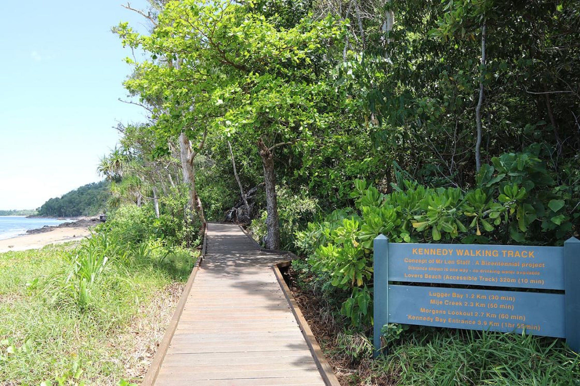
This popular coastal trail is an enjoyable and picturesque four kilometre (one way) route that includes beach and forest walking as well as island views. The track cuts through a wide variety of coastal rainforests to get to beaches and rocky headlands. It offers great views of the Family Group of Islands and the chance to see cassowaries, wallabies and other rainforest animals. Peer down into the ocean from lookout points to spot turtles, dugongs and dolphins. The Kennedy Walking Track takes you from South Mission to Kennedy Bay, past the landing place of 1848 explorer Edmund Beasley Court Kennedy. If you have the time you can then walk the length of Kennedy Bay along the beach to finish at the Hull River. The communities of Hull and Tully Heads are on the other side. Return is via the same pathway. This trail is suitable for a wide range of walkers, although the second half includes more stairs and a bit of rock-hopping. There is a wide boardwalk to the first beach, known as Lover's Beach....
Eddie Santaguiliana Way Logo and Images

Eddie Santaguiliana Way

Eddie Santagiuliana Way, Cleveland QLD 4163
Looking for a walking or cycling trail that’s jam-packed with natural wonders? You need look no further than Eddie Santagiuliana Way on Redlands Coast. This foreshore trail snakes its way from Cleveland to Thornlands and allows you to appreciate nature as you walk or cycle along the shady track. Chances are you will be able to spot a koala in the wild along the ever-changing route, or in one of the adjacent parks. You’ll see wetlands and creeks, mangroves, bushland and other vegetated areas. And then there are breath-taking coastal views over Moreton Bay. You may opt to stop off for a few minutes for a rest and visit duck ponds, or the children’s playground for some extra fun. There are drinking fountains along the way for those who forget their water bottles and toilet facilities. The track, which is relatively flat and features concrete pathways and boardwalks that take you through a variety of habitats, is perfect for children or those of us who are not so fit! It is well signed with interesting information about the wildlife and flora of the area, allowing you to learn more about the natural wonders you are experiencing. Eddie Santagiuliana Way really is a wildlife lover’s paradise....
Federation Walk Logo and Images

Federation Walk

Philip Park, Main Beach QLD 4217
Federation Walk is a 3.5 kilometre pedestrian walkway located on a natural section of the area known as The Spit. Federation Walk begins at a fig tree in the parking lot opposite the entrance to Sea World. The walk continues through patches of rainforest where regular community planting days are held. After leaving the Federation Walk Coastal Reserve, the walk continues under the sand bypass jetty and along the pathway to the southern training wall of the Gold Coast Seaway. The tip of the walk is at the end of the Gold Coast ocean way from where you can take in spectacular views of the coastline. The Federation Walk Coastal Reserve is one of the few remaining areas of undeveloped dune system on the Gold Coast and is part of a regionally significant corridor of coastal vegetation. A network of established paths and tracks throughout this beautiful reserve allow for hiking, jogging, cycling, birdwatching or simply sitting under the trees and listening to the birds singing accompanied by the sounds of the ocean....
Coral Coast Pathways (Burnett Heads to Bargara) Logo and Images

Coral Coast Pathways (Burnett Heads to Bargara)

The Esplanade, Bargara QLD 4670
Discover the spirit of the Bundaberg Region, stroll along the regions diverse beaches. Burnett Heads to Bargara will see you venturing from the marina, along Oaks Beach through the turtle nesting grounds at Mon Repos, following the coastline down Nielson Park, past the coastal town of Bargara to Kelly's Beach. ...
Windorah Nature Drive Logo and Images

Windorah Nature Drive

Maryborough Street, Windorah QLD 4481
This Nature Drive has been developed to help people understand and appreciate their region. Their aim is to maintain the area surrounding the Drive in as near natural state as possible. You can either start the drive just out of Windorah and end up at Cooper’s Creek or vice versa. If it is wet, the black soil section of the Drive nearest the Creek can be skipped by following the alternate road after the grid. The Cooper’s Creek floodplain has a number of distinctly different plant communities, including coolibah woodland, alluvial herb land, lignum shrub land, gidgee open woodland and spinifex grassland. The flat areas of the flood plain adjacent to Cooper’s Creek are usually bare or sparsely vegetated prior to floods. During the floods, the areas are temporarily covered with water. As the water recedes, a dense growth of plants appears. The main channels are lined with the majestic River Red Gum, Coolibah, River Tea Tree and wattles. Many wildlife species rely on this habitat for homes, food and shelter....
Lower Portals track, Mount Barney National Park Logo and Images

Lower Portals track, Mount Barney National Park

Mount Barney National Park, Boonah QLD 4310
The Lower Portals track is one of several tracks around the base of Mount Barney in Mount Barney National Park. The distinctive peaks of Mount Barney, Mount Maroon, Mount May, Mount Lindesay, Mount Ernest, Mount Ballow and Mount Clunie make up Mount Barney National Park. These rugged peaks are the remains of the ancient Focal Peak Shield Volcano which erupted 24 million years ago. Mount Barney is the second highest peak in South East Queensland. Pack a picnic lunch and explore the 7.4 kilometre Lower Portals track. Wander beneath tall spreading eucalypts and brush box trees on the grassy slopes, rising into subtropical rainforest and wet mallee forest—home of the endangered Coxen’s fig-parrot and vulnerable plumed frogmouth. Climb to the Lower Portals, a beautiful pool deep pool set within a rocky gorge of Mount Barney Creek. Please take care at creek crossings as rocks can be slippery, especially after rain. Sit quietly beside the crystal-clear creek and keep an eye out for the tell-tale bubbles of a platypus....
Great Tropical Drive Logo and Images

Great Tropical Drive

51 Esplanade, Cairns City QLD 4870
Explore palm-fringed beaches, ancient rainforests and the golden outback on a self-drive tour taking in the highlights of North Queensland. With 26 different routes to follow, the Great Tropical Drive takes you to some of Australia's best-known tropical attractions including the Great Barrier Reef, Daintree rainforest, Hinchinbrook Island and the Undara Lava Tubes. Taste the flavours of the tropics on the Atherton Tablelands where local produce and fruity wines are popular, step back in time with an adventure into the western goldfields or discover incredible views as you drive between the two World Heritage areas of the Great Barrier Reef and the Wet Tropics rainforest. Along the way you can cool off under a waterfall, visit a turtle hospital, go jungle surfing or learn how to hunt mud crab with a spear. Encounter nature, Indigenous culture, food and wine, wildlife, heritage or adventure and know that natural wonders are around every corner. The Great Tropical Drive offers ever changing landscapes as it passes through unique regions of North Queensland including Cooktown, Port Douglas and Daintree, Cairns and its beaches, Mission Beach and the Cassowary Coast, the Atherton Tablelands, the Gulf Savannah, Townsville, Charters Towers and Hinchinbrook....
Coomera Circuit, Lamington National Park Logo and Images

Coomera Circuit, Lamington National Park

38471 - Binna Burra QLD 4211
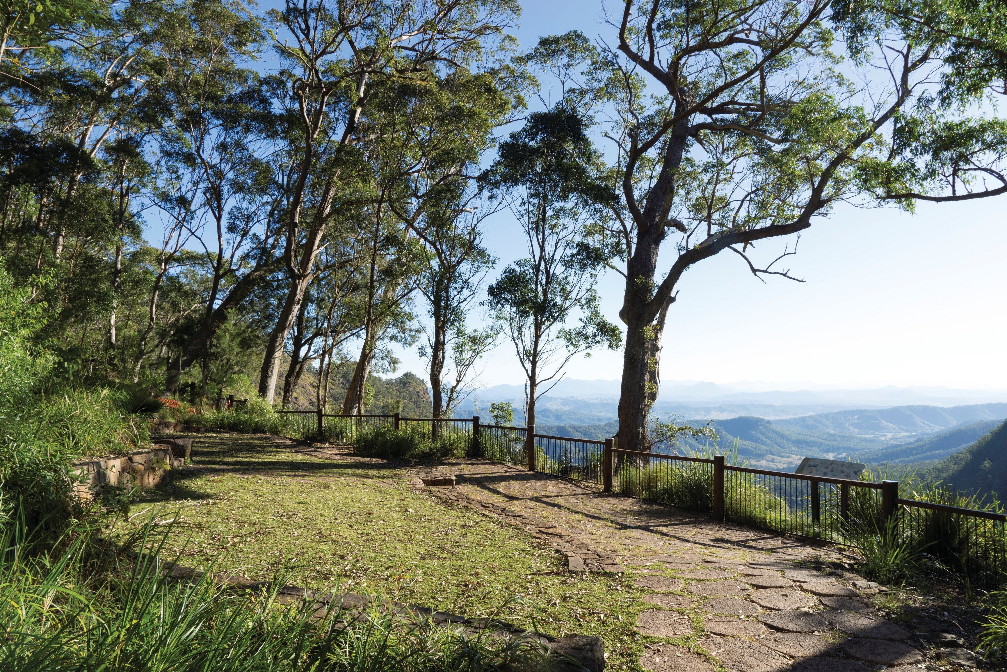
The scenic Coomera circuit in the Binna Burra section of Lamington National Park, leaves the Border Track 1.9 kilometres from the trailhead. It passes through subtropical and warm temperate rainforest communities, and giant brush box forest. Wind down the Beechmont Range and into the Coomera Valley, passing through delicate tea-tree thickets and large stands of eucalypt and brush box. The spectacular cantilevered lookout (5.5 kilometres from the trailhead) hangs over the 160 metre deep gorge and has beautiful views of Yarrabilgong and Coomera falls. The views provide dramatic evidence of the power of erosion, which has cut through a thick resistant rhyolite lava flow. From the lookout, follow the edge of the Coomera Gorge and its waterfall—Gwongorbulli Falls, before passing a series of cascades and waterfalls, the last of which is Goorawa Falls. See if you can spot bright blue and white Lamington spiny crayfish in the pool at the base. The track crosses the river several times before rejoining the Border Track and returning to Binna Burra carpark. This park is part of the Gondwana Rainforests of Australia World Heritage Area, famed for its ongoing geological processes, evolutionary history, and diversity (especially of rare, threatened and endemic species)....
Josephine Falls walking track, Wooroonooran National Park Logo and Images

Josephine Falls walking track, Wooroonooran National Park

Josephine Falls Walk, Wooroonooran QLD 4860
Josephine Creek starts as a gentle trickle high on the summit of Queensland's highest mountain, Bartle Frere. By the time it has travelled the 7.5 kilometres to the smooth granite boulders of Josephine Falls, it is a thundering torrent that will take your breath away. Enjoy the 1.2 kilometre return walk through lush, world heritage-listed rainforest to viewing decks over the picturesque falls. Slip into the bottom pool for an icy dip and then warm up on the smooth granite boulders after your swim Josephine Falls is an extremely refreshing place to visit—but it is also potentially dangerous. Flash flooding (rapidly rising water) is common during wetter months. Rapid and unpredictable water level rises have isolated people on the far bank requiring their rescue. For your safety, access to the top section of the falls is prohibited. Please keep out of the signposted restricted access area, as serious injuries and deaths have occurred here. Penalties apply. Obey all safety signs and only swim in the designated area. Never jump or dive into water—there may be submerged objects. Leave the water immediately if it changes colour or the water levels rise—these are signs of flash flooding....
Mary Cairncross Scenic Reserve Rainforest Walk Logo and Images

Mary Cairncross Scenic Reserve Rainforest Walk

Mary Cairncross Scenic Reserve, Maleny QLD 4552
Learn about endangered species, listen to the striking call of the catbird and imagine yourself back in time as you walk through this stunning patch of remnant rainforest. The Mary Cairncross Scenic Reserve is a wonderful place to take the kids for an adventure and is found one hour's drive north of Brisbane near the hinterland town of Maleny. There are several tranquil walking tracks, boardwalks and viewing platforms where you can soak up the natural beauty and read information about various species. There's also an education centre, café and a number of picnic tables that offer breathtaking views of the Glass House Mountains....
Caves circuit, Lamington National Park Logo and Images

Caves circuit, Lamington National Park

Lamington National Park, Binna Burra QLD 4211
Caves circuit, in the Binna Burra section of Lamington National Park, winds up through open forest and rainforest to emerge on the road near the Binna Burra Mountain Lodge road entrance. Pick up a copy of the self-guiding brochure produced by the Lamington Natural History Association for this circuit, and also the Lamington National Park Discovery Guide from the park's information centre. Take in the brilliant views into the Coomera Valley, the Darlington Range and rhyolite cliff line. Possibly the largest intact stand of hoop pine in Australia can be seen along the Darlington Range. As you pass through the Kweebani Caves, think back to a time when they sheltered the original inhabitants of this area—the Yugambeh Aboriginal kinship group. From the caves you’ll climb to the summit of Mount Roberts through rainforests of immense red cedars and other trees. White-throated treecreepers, members of one of the oldest groups of songbirds, are frequently seen on this circuit. Koalas are often seen in open forest areas along the walk. Take care when walking beside the bitumen road to return to the start of the circuit, especially on weekends when traffic is busy, or alternatively walk back along the circuit. This park is part of the Gondwana Rainforests of Australia World Heritage Area, famed for its ongoing geological processes, evolutionary history, and diversity (especially of rare, threatened and endemic species). Image credits: Walkers—Nicholas Hill © Queensland Government Cave—© Pamela Harmon-Price...
Gympie Region Food Trail Logo and Images

Gympie Region Food Trail

41559 - Gympie QLD 4570
Gympie Regional Council welcomes you to the Gympie region and hopes this food trail map helps you to discover, plan and enjoy your visit to their beautiful region. Gympie Gold Regional Produce aims to help you be inspired to taste, create, buy, stay, play, dine, learn and connect with their growers, producers, retailers, processors, cafes and restaurants and find out all about the fantastic food related events from near and far. Whether you’re taking the western drive out to Kilkivan and Goomeri to explore the richness of the country landscapes and towns have to offer. Going east to soak up the natural beauty of the coastal towns of Tin Can Bay and Rainbow Beach through Goomboorian, taking one of the many scenic routes through the picturesque and fertile Mary Valley or simply stopping to explore the regions historic city centre of Gympie, with the unsurpassed beauty and a wealth of natural attractions from the ocean to the hinterland they’re sure that this region has something for everyone. So they invite you to stay, unwind, relax, explore and simply enjoy the diversity and vibrancy of everything that the region has to offer....
Bluewater Trail Public Art Logo and Images

Bluewater Trail Public Art

320 Nebo Road, West Mackay QLD 4740
One of the most significant public art developments in Australia can be experienced in The Mackay Region. The Bluewater Trail Public Art display consists of six installations by Queensland artist, Fiona Foley. All installations are in the Mackay City Centre beside Mackay's bluewater Pioneer River. An information map can be downloaded from the Artspace Mackay website....
Oceanview Walk, Burleigh Head National Park Logo and Images

Oceanview Walk, Burleigh Head National Park

Burleigh Head National Park, Burleigh Heads QLD 4220
Ancient volcanic columns meet the sea on this easy stroll in Burleigh Head National Park in the heart of the Gold Coast. The Oceanview track skirts the coastline leading around the rocky headland from the southern edge of Burleigh Heads township to the southern [park entrance near Tallebudgera Creek. Pack a picnic and relax by the creek at Echo Beach and marvel at the tumbled masses of six sided basalt columns. Spot whales (during winter and spring), white-bellied sea-eagles and birdwing butterflies (in summer). Allow 30 minutes from the rocky headland at Tallebudgera Creek to walk the track through pandanus groves, tussock grasslands, coastal heath and mangroves to southern Burleigh. You can either return by the same path or via the Rainforest circuit and Tumgun lookout. For your safety, a section of Oceanview walk may be temporarily closed before, during and after severe weather, due to the increased risk of rock falls. Check Park Alerts for track closures. For your safety, please observe the DANGER boulder fall zone restricted access area sign and remain on the walking track. Access is not permitted to the boulder fields, including Cannon Rock, or the steep slopes between the Oceanview track and the boulder fields—penalties apply....
Bushwalking on Keswick Island Logo and Images

Bushwalking on Keswick Island

320 Nebo Road, West Mackay QLD 4740
Keswick Island has many trails along which you can walk to explore the island. Trails wind through tropical vegetation, up hilly climbs that reward you with spectacular views, or along sandy beaches and fringing reef at low tide. Bushwalking on Keswick is a great way to marvel at the natural treasures that change with the season. For further information on tracks and walking tips, visit the Keswick Kiosk....
Bluff Point circuit, Capricorn Coast National Park Logo and Images

Bluff Point circuit, Capricorn Coast National Park

Capricorn Coast National Park, Yeppoon QLD 4703
Explore the Bluff Point circuit in the Bluff Point section of Capricorn Coast National Park, and enjoy panoramic views of the Capricorn coastline and the Keppel Bay islands. Climb the steep 600 metres to Turtle Lookout to admire the flooded hill tops of the Keppel Bay islands and spot turtles swimming in the water beneath you. Continue a short distance to Ritamada Outlook for views along the coast and return the way you came or continue along the track through open grasslands with views of the hinterland, and dense dry rainforest to complete the 2.3 kilometre circuit. Bluff Point section, at the southern end of Kemp Beach, is a popular picnic spot with superb coastal scenery. It features a range of coastal vegetation from mangroves and heath lands to open eucalypt forests and tussock grasslands and is the largest trachyte plug on the Capricorn Coast. Take a picnic with you to enjoy at lookouts at Bluff Point, or enjoy a barbecue at the picnic facilities—toilets and automatic barbecues are provided just a short walk from the car park. Alternatively pack a picnic lunch to enjoy on one of the beaches nearby....
Bribie Island Bicentennial Trails Logo and Images

Bribie Island Bicentennial Trails

- Western Foreshore, Bribie Island QLD 4507
If you enjoy a stroll through eucalypt forest and paperbark wetlands, then make your way to the Bribie Island Bicentennial Trail. A 3.8 kilometre circuit, the Bribie Island Bicentennial Trails begin at the Bribie Island Community Arts Centre on Sunderland Drive. The sandy track features Banksia, Palm Grove, and Melaleuca Bribie Island walks which branch-off the main circuit giving visitors the chance to enjoy strolls through eucalypt forests, paperbark wetlands, and even wallum heathlands. Bring a picnic and enjoy a morning of bird spotting!...
Gympie Canoe and Kayak Water Trail Logo and Images

Gympie Canoe and Kayak Water Trail

The Sands Car Park, Gympie QLD 4570
Enjoy the waterway of the Gympie region and paddle the Mary Rivert and its tributaries from six launch points in Gympie, Imbil and Kandanga. Parts of the trail meander through privately-owned farmland and you may encounter fencing barriers. Please be considerate when travelling in privately-owned areas and stay within the waterway. Designated off-street parking areas are available at all launch point locations....
Sunset Track Logo and Images

Sunset Track

Baldwin Swamp Conservation Park, Bundaberg QLD 4670
Fondly referred to as Bundaberg's own slice of Kakadu with its lush wetlands, abundant birdlife and fish breeding habitats, Baldwin Swamp provides a range of authentic wetland experiences, right in the heart of the city. Only five minutes from the Bundaberg Central Business District, the conservation park has nearly a one kilometre series of walkways that wind through the park. Take a punt at picking out some of the 75 species of waterbirds that call the swamp home. Baldwin Swamp isn't just perfect at sunset - you can visit anytime of the day and at night you might encounter Possums, Bandicoots and the ever elusive Echidna foraging for their dinner. ...
Queen Mary Falls circuit, Main Range National Park Logo and Images

Queen Mary Falls circuit, Main Range National Park

Queen Mary Falls section, Killarney QLD 4373
Take a leisurely stroll through changing forests to the top, and then the base, of spectacular Queen Mary Falls. From the Queen Mary Falls picnic area, head along a fragrant eucalypt-topped ridgeline to the lush, rainforested gorge. At the lookout, watch Spring Creek plunge 40 metres over the falls to the valley floor. Marvel at the rainbows created by the waterfall’s sheer mist, and watch as the creek continues its twisting journey along the valley, to join the Condamine River’s upper reaches. Continue along the track to the valley floor and cool off in the waterfall’s misty spray—perfect on a hot summer's day. Park Rangers suggest walking the circuit in a clockwise direction as it is easier on the legs! Take care on the causeway as the surface can become slippery when wet. Do not attempt to cross when in flood or if water covers the causeway. This park is part of the Gondwana Rainforests of Australia World Heritage Area, famed for its ongoing geological processes, evolutionary history, and diversity (especially of rare, threatened and endemic species)....
Bluewater Trail Logo and Images

Bluewater Trail

River Street, Mackay QLD 4740
See highlights of Mackay along the Bluewater Trail, a shared bicycle and pedestrian walkway which connects art, historic architecture and points of interest with natural beauty. The Bluewater Trail is approximately 20 kilometres in length, linking key attractions, including the picturesque Mackay Regional Botanical Gardens and the Bluewater Lagoon to Mackay's natural features, the Pioneer River and Town Beach. A feature along the trail is the inclusion of six public art installations, each uniquely representing a piece of Mackay's history and diversity. The public art can be viewed along Bluewater Quay. More impressive public art can be seen above the bank of the Pioneer River. The Catherine Freeman walk crosses over the wetland adjacent to the Pioneer River and links Mackay's Central Business District with the Botanical Gardens. The Sandfly Creek Environmental walk stretches from Bluewater Quay, where another fishing pier can be found, and makes its way across grassland toward the Pioneer River mouth, before turning to head toward Town Beach. This conservation area is popular with bird-watchers. The Bluewater Trail includes the popular Bluewater Lagoon, a three-tier swimming facility with waterslide. Entry is free and lifeguards monitor the pools....
Misty Mountains Wilderness Tracks Logo and Images

Misty Mountains Wilderness Tracks

Tully Falls Road, Ravenshoe QLD 4888
Delve deeply into the Wet Tropics World Heritage Area along the 130 kilometre network of the Misty Mountains wilderness tracks. The world heritage area is famed for its exceptional natural beauty, outstanding examples of the record of life, evolutionary history and remarkable diversity. Discover lush, high altitude rainforest dotted with crystal clear creeks, stunning waterfalls and panoramic views. The Misty Mountains wilderness tracks extend from the coastal plain to the tablelands. Four long tracks—the Koolmoon Creek, Cannabullen Creek, Cardwell Range and Gorrell tracks—make up the Misty Mountains wilderness tracks. Tackle a long hike or explore smaller fragments of the tracks. Some tracks are suitable only for bushwalkers, while others are shared tracks with mountain biking permitted. Tracks are remote and can be indistinct with encroaching vegetation. Always check Park alerts for latest conditions before you plan your visit. Seven small camping areas (with no facilities) are provided at specific sites along the tracks. Camping permits are required....
Banksia Track, Burrum Coast National Park Logo and Images

Banksia Track, Burrum Coast National Park

Burrum Coast National Park, Woodgate QLD 4660
Woodgate, in Burrum Coast National Park, is known for the long, white stretches of sandy beaches that overlook the magnificent Southern Great Barrier Reef. Strap on your walking boots and experience some of Australia's distinctive flora and fauna as you walk the Banksia track. At the beginning of the walk, a paperbark-lined boardwalk provides wheelchair access for 800 metres through melaleuca wetland. The track then opens up to a 5.2 kilometre experience like no other with tea trees and the brown banksia dotting the landscape. Keep an ear out for the wattle and friarbirds and decide who wins the loudest battle as the loudest amongst the banksia's foliage. A flash of fire engine red might just be the scarlet honeyeater, a streak of emerald green a King Parrot, the chorus of the distinctive whipbird and the grey shrikethrush are just some of the 200 plus bird species spotted in the park. Take a stroll and take in the vistas, sounds and smells of mangrove-lined riverbanks, wallum heath, swamp banksia, wallum banksia, tea tree wetlands, eucalypt forests and spectacular wildflowers and bird life throughout August to October (when everything is in full bloom). Image credits: Chris Whitelaw...
Whitsunday Ngaro Sea Trail, Whitsunday Islands National Park Logo and Images

Whitsunday Ngaro Sea Trail, Whitsunday Islands National Park

Whitsunday Islands National Park, Whitsundays QLD 4802
***NOTE: as a response to COVID-19, all camping areas in Queensland's national parks are closed to the public until further notice. Check park alerts for updates. Discover your own slice of tropical paradise on the Whitsunday Ngaro Sea Trail, a unique blend of seaways and picturesque walks across Whitsunday, South Molle and Hook islands. Pack up the boat or sea kayak and head off to explore this timeless landscape. From Shute Harbour the trail circumnavigates Whitsunday Island, and includes stops on Hook and South Molle islands. If you intend to kayak the sea trail, discuss your plans with QPWS first. Camping areas along the sea trail are accessible by boat or kayak only. Camping permits are required. Explore a variety of short walks (under 3 kilometres return) to enjoy picturesque views on Whitsunday and Hook islands. Or tackle longer more challenging walks (4-8 kilometres return) on Whitsunday and South Molle islands. Be sure to stop at Nara Inlet on Hook Island for the chance to immerse yourself in the Ngaro Cultural Site, a 340 metre return walk up the side of the inlet to a viewing platform at the cave's entrance, where Ngaro artwork adorns the fragile rock surface. There's no more exciting way to explore the natural beauty and amazing diversity of this part of the Great Barrier Reef World Heritage Area....
Morelia walking track, D'Aguilar National Park Logo and Images

Morelia walking track, D'Aguilar National Park

Manorina, Mount Nebo QLD 4520
The Morelia walking track is in southern D'Aguilar National Park. Starting from Manorina, this walk explores patches of cool rainforest and open eucalypt forest before reaching Mount Nebo lookout. Discover wet eucalypt forest and groves of cabbage tree palms, their huge fan-shaped leaves spreading overhead like umbrellas. Listen for the booming ‘wallock-a-woo’ and ‘book-a-roo’ call of wompoo fruit-doves calling in the canopy. Catch your breath at the natural rock outcrop of Mount Nebo lookout and admire magnificent views over Samford Valley, Mount Tempest and Moreton Bay. On a clear day, the Moreton Island sand dunes appear to strangely hover on the horizon. If you're keen to keep walking, Manorina is also the starting point for the short and family-friendly Atrax circuit. This six kilometre return walking track is mostly gently-sloping and well-defined track but it is quite steep in some places. Return along the same track. You need about two hours to complete this moderately difficult grade track....
1770 Headland and Lookout Logo and Images

1770 Headland and Lookout

Endeavour Street, Seventeen Seventy QLD 4677
Long, golden beaches, white waves crashing into the rocks below, aquamarine ocean as far as you can see and if it's whale season you might just spot a water spouting out of a blowhole on this short, headland walk. You don't need to huff and puff to get to the best views of 1770 and surrounds, this easy family-friendly walk will do the trick and it only takes 30 minutes. You can easily access a few lookout walks from the car park at the 1770 headland so this is another activity to add to your list while in the 1770 and Agnes Water area. Swap your surfboard for sneakers for a morning or afternoon and traverse the area by foot instead of waves....
Barron Falls Lookout Track, Barron Gorge National Park Logo and Images

Barron Falls Lookout Track, Barron Gorge National Park

Barron Gorge Road, Kuranda QLD 4881
This walk is in the upper section of Barron Gorge National Park, accessed via Kuranda. Explore this elevated, wheelchair-accessible walkway, suspended high above the forest floor, as it winds through lush rainforest and open eucalypt forest canopy to Din Din Barron Falls lookouts. Find out about the nature and culture of Barron Falls and the gorge area from wayside signs. When you reach the lookout, enjoy views over the gorge and scenic Barron Falls. In the wet months, you will be enveloped in a cloud of mist as the falls thunder spectacularly down the gorge. In drier times, enjoy the scenic falls as they tumble endlessly over water-sculpted rocks of the narrow gorge walls. Watch the gondolas on the Skyrail Rainforest Cableway glide above the far-side of the gorge and, twice each day, watch the Kuranda Scenic Railway tourist train pull into the platform below the lookout. Take care near the railway line. Toilets are located in the car park....
Redcliffe Botanic Gardens Logo and Images

Redcliffe Botanic Gardens

Henzell Street, Redcliffe QLD 4020
The Redcliffe Botanic Gardens is a tranquil haven, right in the heart of the city. It provides a quick escape from the rigours of everyday life. It is the perfect place to have a picnic, celebrate a birthday or simply enjoy a quiet moment in the beautiful surrounds in Redcliffe. This site has been transformed by the Council and local community groups into a natural wonderland boasting a wide variety of native Australian plants. The Gardens have a multitude of picturesque and shaded areas, which provide a popular place for gatherings. There are shelters, seating and drinking fountains provided at various locations as well as facilities for people with a disability....
Brisbane Valley Rail Trail Logo and Images

Brisbane Valley Rail Trail

Brisbane Valley Highway , Fernvale QLD 4306
Explore the great outdoors and uncover treasures along Australia's longest recreational rail trail, The Brisbane Valley Rail Trail. The trail follows the old Brisbane Valley Railway line for 161 kilometres from Wulkuraka to Yarraman. The trail is a mecca for mountain bikers, horse riders, hikers and dog walkers who enjoy the excitement of experiencing a range of environments. Along the journey, rail trailers experience a range of rural landscapes, creek crossings and historic landmarks. As the Brisbane Valley Rail Trail takes in many of Somerset's towns, visitors can choose how much or how little of the trail they would like to experience. The original rail line was built in the 1880's to transport timber, milk and beef to Brisbane and supply farmers and towns along the railway line. Brisbane Valley Rail Trail sections: Wulkuraka to Fernvale – 23 kilometres. Fernvale to Lowood – 8 kilometres. Lowood to Coominya – 12 kilometres. Coominya to Esk – 24 kilometres. Esk to Toogoolawah – 19 kilometres. Toogoolawah to Harlin -14 kilometres. Harlin to Moore – 13 kilometres. Moore to Linville – 7 kilometres. Linville to Bernarkin – 17k kilometres. Bernarkin to Blackbutt – 5 kilometres. Blackbutt to Yarraman – 19kilometres....
Mt Coot-tha Tourist Drive Logo and Images

Mt Coot-tha Tourist Drive

Mt Coot-tha Rd, Toowong QLD 4066
The Mt Coot-tha Scenic Drive takes a circuitous route through the Mount Coot-tha Forest and Walkabout Creek section of D'Aguilar National Park. Begin at the Brisbane Botanic Gardens Mt Coot-tha and Sir Thomas Brisbane Planetarium, from here the drive winds past picturesque barbecue and picnic sites to the city's premier lookout. Mt Coot-tha Lookout is by far the best way to look over Brisbane. It boasts breathtaking views out to Moreton Bay and the Sunshine Coast Hinterland during the day and Brisbane's glittering cityscape at night. The entire Mount Coot-tha area is a natural reserve featuring a number of moderate to steep walks throughout the Mt Coot-tha Forest. The open eucalypt forest is home to a range of wildlife, and a huge variety of bird species. Visit the J C Slaughter Falls Park where a moderate walk will lead you to the semi-rainforest shrouded falls....
Kilkivan to Kingaroy Rail Trail Logo and Images

Kilkivan to Kingaroy Rail Trail

Bridge Street, Kilkivan QLD 4600
The Kilkivan to Kingaroy Rail Trail is an 88 kilometre recreation trail following the old Kingaroy Branch Railway Line. The rail trail between Kilkivan, Goomeri and Murgon is a natural formation and most suitable for mountain bikers, bushwalkers and horse riders (some sections only). There are amenities on the trail between the townships....
Sandy Creek Track Logo and Images

Sandy Creek Track

Mt Flinders Road, Peak Crossing QLD 4306
The Sandy Creek Track forms part of the Flinders-Goolman Conservation Estate managed by Ipswich City Council, and is accessed from the Flinders Plum Picnic Area off Mt Flinders Road in Peak Crossing, just south of Ipswich. Visitors to the Estate can take in the natural wonders of the area through a range of recreational activities including hiking, mountain bike riding and horse riding. The conservation estate is over 1,900 hectares in area supporting extensive forests and rugged volcanic peaks and slopes including Flinders Peak, and Mounts Blaine, Catherine and Goolman. The Estate is an important wildlife refuge supporting 136 bird, 25 mammal, 13 reptile and eight amphibian species as well as 531 different flora species. The Sandy Creek Track will take you on a walk through patches of majestic Hoop Pine forests following Sandy Creek on this moderate level, shared trail hike....
Mount Ngungun summit walking track, Glass House Mountains National Park Logo and Images

Mount Ngungun summit walking track, Glass House Mountains National Park

Fullertons Road, Glass House Mountains QLD 4518
The Glass House Mountains National Park is noted for its distinctive craggy peaks that tower above the surrounding landscape. Formed by volcanic activity millions of years, these ancient rocky outcrops are of special significance to the Gubbi Gubbi Aboriginal people. The Mount Ngungun summit walking track is a 2.8 kilometre trail that begins in open forest and offers great views of Mount Tibrogargan, Mount Coonowrin and Mount Beerwah from the summit. Don't forget to pack your camera as you'll find a 360 degree panoramic view of the coast and hinterland at the top! Listed as a Grade 4 walking track, you will need to have a moderate level of fitness for this track, which will take about two hours to complete. Be sure to take plenty of water, wear supportive boots and sun protection. Caution: This track passes close to cliff edges so please supervise children closely. Take extra care around the summit area in wet weather as rocks can become very slippery....
Mount Tempest Lookout Track, Moreton Island National Park and Recreation Area Logo and Images

Mount Tempest Lookout Track, Moreton Island National Park and Recreation Area

National Park, Moreton Island QLD 4009
Mount Tempest track is on Moreton Island National Park, which features crystal clear creeks and lagoons, coastal heath, rocky headlands, abundant wildflowers, tall sand dunes, an historic lighthouse, ruins of coastal forts and miles of sandy beaches. Tidal wetlands and waters around the island are protected as part of Moreton Bay Marine Park. Not for the faint-hearted, the Mount Tempest lookout track features a steep climb to a summit measuring 280 metres in elevation. Expect many steps. Seats are provided along the way and at the lookout. Hike through stands of gums and grasstrees to a mountain-top lookout, stopping to catch your breath along the way. After your steep climb, be rewarded with 360-degree views. Marvel at breathtaking panoramic views of the island and Moreton Bay Marine Park—on a clear day you can make out the volcanic peaks of the Glass House Mountains in the distance. Reflect upon the stories of the island’s Indigenous People and their unique connection with this landscape from signs at the lookout. Image credits: Leanne Siebuhr © Queensland Government...