Trails Attractions {region} {suburb} - Holiday Gold Coast

ATTRACTIONS TRAILS

Sheepstation Creek Conservation Park Logo and Images

Sheepstation Creek Conservation Park

Mackney Road, Upper Caboolture QLD 4510
The shared use loop trail is set amongst the tranquil grassy open forest of Sheepstation Creek Conservation Park in Upper Caboolture. The trail starts at the Phelps Road Trail Head and runs around the outer perimeter of the park with connections to the Spotted Gum and Ironbark Ridge Trails. The trail provides a great opportunity for horse riding, walking and nature appreciation. There are three walking circuits, which are all within an easy walking classification. The Grey Gum Circuit is a 4.4-kilometre loop, which is suitable for walkers and horse riders. The Spotted Gum Trail is a 1.2-kilometre one-way track that generally takes 20 minutes and is suitable for walkers only. The Ironbark Ridge Trail is a 1.1-kilometre one-way track that is suitable for walkers only. The best starting point for this track is McLoughlin Road....
Coomera Circuit, Lamington National Park Logo and Images

Coomera Circuit, Lamington National Park

38471 - Binna Burra QLD 4211
The scenic Coomera circuit in the Binna Burra section of Lamington National Park, leaves the Border Track 1.9 kilometres from the trailhead. It passes through subtropical and warm temperate rainforest communities, and giant brush box forest. Wind down the Beechmont Range and into the Coomera Valley, passing through delicate tea-tree thickets and large stands of eucalypt and brush box. The spectacular cantilevered lookout (5.5 kilometres from the trailhead) hangs over the 160 metre deep gorge and has beautiful views of Yarrabilgong and Coomera falls. The views provide dramatic evidence of the power of erosion, which has cut through a thick resistant rhyolite lava flow. From the lookout, follow the edge of the Coomera Gorge and its waterfall—Gwongorbulli Falls, before passing a series of cascades and waterfalls, the last of which is Goorawa Falls. See if you can spot bright blue and white Lamington spiny crayfish in the pool at the base. The track crosses the river several times before rejoining the Border Track and returning to Binna Burra carpark. This park is part of the Gondwana Rainforests of Australia World Heritage Area, famed for its ongoing geological processes, evolutionary history, and diversity (especially of rare, threatened and endemic species)....
Gympie Canoe and Kayak Water Trail Logo and Images

Gympie Canoe and Kayak Water Trail

The Sands Car Park, Gympie QLD 4570
Enjoy the waterway of the Gympie region and paddle the Mary Rivert and its tributaries from six launch points in Gympie, Imbil and Kandanga. Parts of the trail meander through privately-owned farmland and you may encounter fencing barriers. Please be considerate when travelling in privately-owned areas and stay within the waterway. Designated off-street parking areas are available at all launch point locations....
Mount Tempest Lookout Track, Moreton Island National Park and Recreation Area Logo and Images

Mount Tempest Lookout Track, Moreton Island National Park and Recreation Area

National Park, Moreton Island QLD 4009
Mount Tempest track is on Moreton Island National Park, which features crystal clear creeks and lagoons, coastal heath, rocky headlands, abundant wildflowers, tall sand dunes, an historic lighthouse, ruins of coastal forts and miles of sandy beaches. Tidal wetlands and waters around the island are protected as part of Moreton Bay Marine Park. Not for the faint-hearted, the Mount Tempest lookout track features a steep climb to a summit measuring 280 metres in elevation. Expect many steps. Seats are provided along the way and at the lookout. Hike through stands of gums and grasstrees to a mountain-top lookout, stopping to catch your breath along the way. After your steep climb, be rewarded with 360-degree views. Marvel at breathtaking panoramic views of the island and Moreton Bay Marine Park—on a clear day you can make out the volcanic peaks of the Glass House Mountains in the distance. Reflect upon the stories of the island’s Indigenous People and their unique connection with this landscape from signs at the lookout. Image credits: Leanne Siebuhr © Queensland Government...
Wynnum North Mangrove Circuit Logo and Images

Wynnum North Mangrove Circuit

Bayside Parklands, Wynnum QLD 4178
An elevated walkway winding through the forest, the Wynnum North Mangrove Circuit enables visitors to observe at close hand the plants and animals of the mangroves. There is seating along the way, and a vantage point located at the seaward end of the boardwalk provides sweeping views of Moreton Bay and some of its islands. To find it: follow Wynnum Road, past the intersection of Tingal Road onto Glenora Street. Turn left into Granada Street and follow the road to the signposted entrance in Elanora Park....
Kingaroy to Kilkivan Rail Trail - South Burnett Section Logo and Images

Kingaroy to Kilkivan Rail Trail - South Burnett Section

O'Neill Square , Kingaroy QLD 4610
Welcome to Queensland's first sealed rail trail, a 43.5 kilometre recreation trail between Kingaroy and Murgon in the beautiful South Burnett, only two and a half hours from Brisbane. Whether you choose to cycle, run or walk the South Burnett Rail Trail is suitable for all ages. Dogs on leads are welcome, please clean up after your pet. The Kilkivan to Kingaroy Rail Trail starts at O'Neill Square in the centre of Kingaroy and progresses north. Visitors travelling the trail will enjoy picturesque surrounds and welcoming, country towns. Choose your own adventure, there's plenty to see and do as you journey through Kingaroy, Crawford, Memerambi, Wooroolin, Tingoora, Wondai and Murgon. Short distances between towns means a spot to refresh is never too far away. Enjoy a break and recharge with coffee at the cafes along the route or experience lunch at an authentic country pub. The Kilkivan to Kingaroy Rail Trail allows families to enjoy the great outdoors safely and encourages people of all ages to be active and enjoy fresh country air and a healthy lifestyle....
Bundaberg City Heritage Treasures Logo and Images

Bundaberg City Heritage Treasures

36 Avenue Street, Bundaberg East QLD 4670
Bundaberg has a wealth of heritage treasures for the history-conscious. This journey is a small sample taken from the heritage walk, including School of Arts, Post Office, Linden Clinic, Dental Surgery, Old Australia Bank, Christ Church and the Holy Rosary Church. Further details on these buildings can be found at the local information centre. Alphabetic list of suggested stops: ANZAC Memorial Balcony Black's Building Blockbuster Video Bundaberg Arts Centre Burnett Traffic Bridge Buss & Turner Buss Park and Hinkler Memorial Civic Centre Council Chambers Dental Surgery Facade Grand Hotel Linden Clinic Old Bank Building Old Department of Works Old National Australia Bank Old Police Station Post Office QUNABA House Railway Bridge Robert Cullen Pharmacy RSL School of Arts Senior Citizens Community Centre...
Coastal walk, Noosa National Park Logo and Images

Coastal walk, Noosa National Park

Noosa National Park, Noosa Heads QLD 4567
In popular Noosa National Park, follow the shoreline between Noosa Headland day-use area and Sunshine Beach, on this walk, passing over several headlands boasting outstanding views across coastal she-oaks and pandanus palms. Peer into the trees in search of koalas snoozing or munching on leaves. Feel the sea spray and feel the thunderous sounds of waves crashing ferociously into the rugged rocks at Boiling Pot, Dolphin Point and Hell's Gates. The first section of this walk features a sealed, barrier-free path to Dolphin Point, suitable for strollers. The path is suitable for assisted-wheelchair access to Boiling Pot, beyond this, the 1.2km walk to Dolphin Point has steeper gradients in places. At Dolphin Point, see if you can spot a pod of passing dolphins. The track from here to Hell’s Gates is an uneven, gravel and sand track. At Hell's Gates you will be greeted with incredible coastal views unlike anything you’ve seen before. Visit between June and November and you might spot humpback whales cruising past the coastline on their way to and from northern breeding grounds. Watch from several vantage points as turtles and dolphins drift and skim through the waves....
Rotary Walk Logo and Images

Rotary Walk

Morayfield Road, Caboolture QLD 4510
A number of shared paths meander around lakes and gardens, with viewing platforms doted along the way where you can rest and watch the abundant birdlife. Fun outdoor exercise equipment can be found in some areas. Bridges cross over streams and lead into rainforest areas which offer another dimension in experience in this diverse location....
Mary Cairncross Scenic Reserve Rainforest Walk Logo and Images

Mary Cairncross Scenic Reserve Rainforest Walk

Mary Cairncross Scenic Reserve, Maleny QLD 4552
Learn about endangered species, listen to the striking call of the catbird and imagine yourself back in time as you walk through this stunning patch of remnant rainforest. The Mary Cairncross Scenic Reserve is a wonderful place to take the kids for an adventure and is found one hour's drive north of Brisbane near the hinterland town of Maleny. There are several tranquil walking tracks, boardwalks and viewing platforms where you can soak up the natural beauty and read information about various species. There's also an education centre, café and a number of picnic tables that offer breathtaking views of the Glass House Mountains....
North Keppel Island Hilltop Trail Logo and Images

North Keppel Island Hilltop Trail

Keppel Bay Islands National Park, Yeppoon QLD 4703
North Keppel Island Hilltop Trail is located on North Keppel Island within Keppel Bay Islands National Park. Steep hills and cliffs, which plunge into the sea, are features of the islands but there are also sheltered bays and quiet sandy beaches. The Great Barrier Reef Marine Park surrounds the Keppel Bay islands. Together they form part of the Great Barrier Reef World Heritage Area, the world's largest reef and island system. It is of exceptional beauty and biological diversity, protecting many endangered animals and plants. The 5.3 kilometre one way Island Hilltop Trail departs from the information shelter at Considine Beach's southern end. This walk begins on the Mazie Bay track then turns onto the Keppel Bay lookout track, which offers views of the island, Mazie Bay and other northern islands. It is a short 850 metre walk uphill to the Keppel Bay lookout. For the Island Hilltop track, continue past the Keppel lookout. This bush track winds through pockets of Banks' grevillea (Grevillea banksii) and grass-cloaked hilltops on the eastern side of the island and offers spectacular views of the ocean, islands and coast. The Island Hilltop Trail is of a moderate grade....
Kilkivan to Kingaroy Rail Trail Logo and Images

Kilkivan to Kingaroy Rail Trail

Bridge Street, Kilkivan QLD 4600
The Kilkivan to Kingaroy Rail Trail is an 88 kilometre recreation trail following the old Kingaroy Branch Railway Line. The rail trail between Kilkivan, Goomeri and Murgon is a natural formation and most suitable for mountain bikers, bushwalkers and horse riders (some sections only). There are amenities on the trail between the townships....
Mount Blaine Hiking Track Logo and Images

Mount Blaine Hiking Track

Mt Flinders Road, Peak Crossing QLD 4306
The Mount Blaine Hiking Track forms part of the Flinders-Goolman Conservation Estate managed by Ipswich City Council, and is accessed from the Flinders Plum Picnic Area off Mt Flinders Road in Peak Crossing, just south of Ipswich. Visitors to the Estate can take in the natural wonders of the area through a range of recreational activities including hiking, mountain bike riding and horse riding. The conservation estate is over 1900 hectares in area supporting extensive forests and rugged volcanic peaks and slopes including Flinders Peak, and Mounts Blain, Catherine and Goolman. The Estate is an important wildlife refuge supporting 136 bird, 25 mammal, 13 reptile and eight amphibian species as well as 531 different flora species. Take a short hike to the foot of Mount Blaine along the Mount Blaine Hiking Track. Needing a moderate level of fitness, you will pass through spotted gum and ironbark forests, brushbox and heathland. Keep an eye out for koalas, wallabies and the magnificent Red-tailed Black Cockatoos that call this area home....
Hawkings Point Track Logo and Images

Hawkings Point Track

Hawkings Point Lookout, Magnetic Island QLD 4819
Starting at the eastern end of Picnic Street in Picnic Bay, follow a track that will lead you to the saddle between Rocky Bay and Picnic Bay. Here, you will have a decent view over Rocky Bay. From here, you can even scramble down to Rocky Bay. Otherwise, the track then winds to the top of a large boulder, offering views over toward Picnic, Nelly, and Geoffrey Bays and back toward Townsville. This is Hawkings Point Lookout. One of the best places to watch sunrise and sunset on Magnetic Island....
Bluewater Trail Public Art Logo and Images

Bluewater Trail Public Art

320 Nebo Road, West Mackay QLD 4740
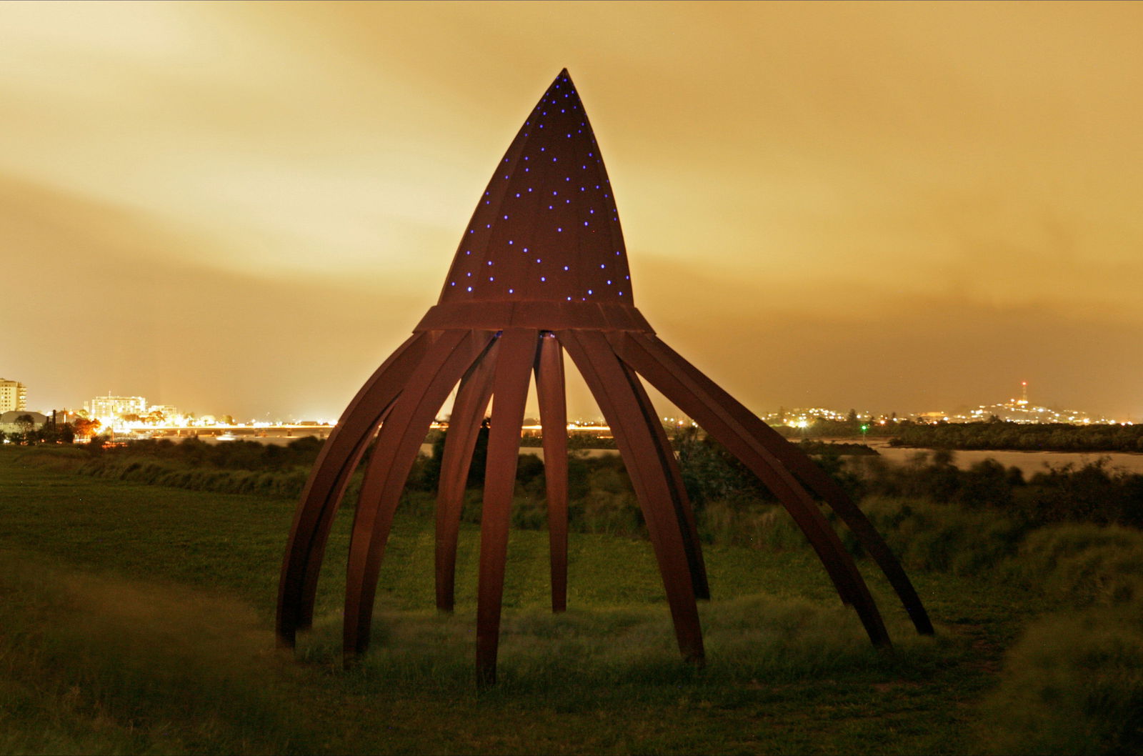
One of the most significant public art developments in Australia can be experienced in The Mackay Region. The Bluewater Trail Public Art display consists of six installations by Queensland artist, Fiona Foley. All installations are in the Mackay City Centre beside Mackay's bluewater Pioneer River. An information map can be downloaded from the Artspace Mackay website....