National parks and reserves Attractions - Holiday Gold Coast

ATTRACTIONS NATIONAL PARKS AND RESERVES

Capricorn Coast National Park Logo and Images

Capricorn Coast National Park

Capricorn Coast National Park, Yeppoon QLD 4703
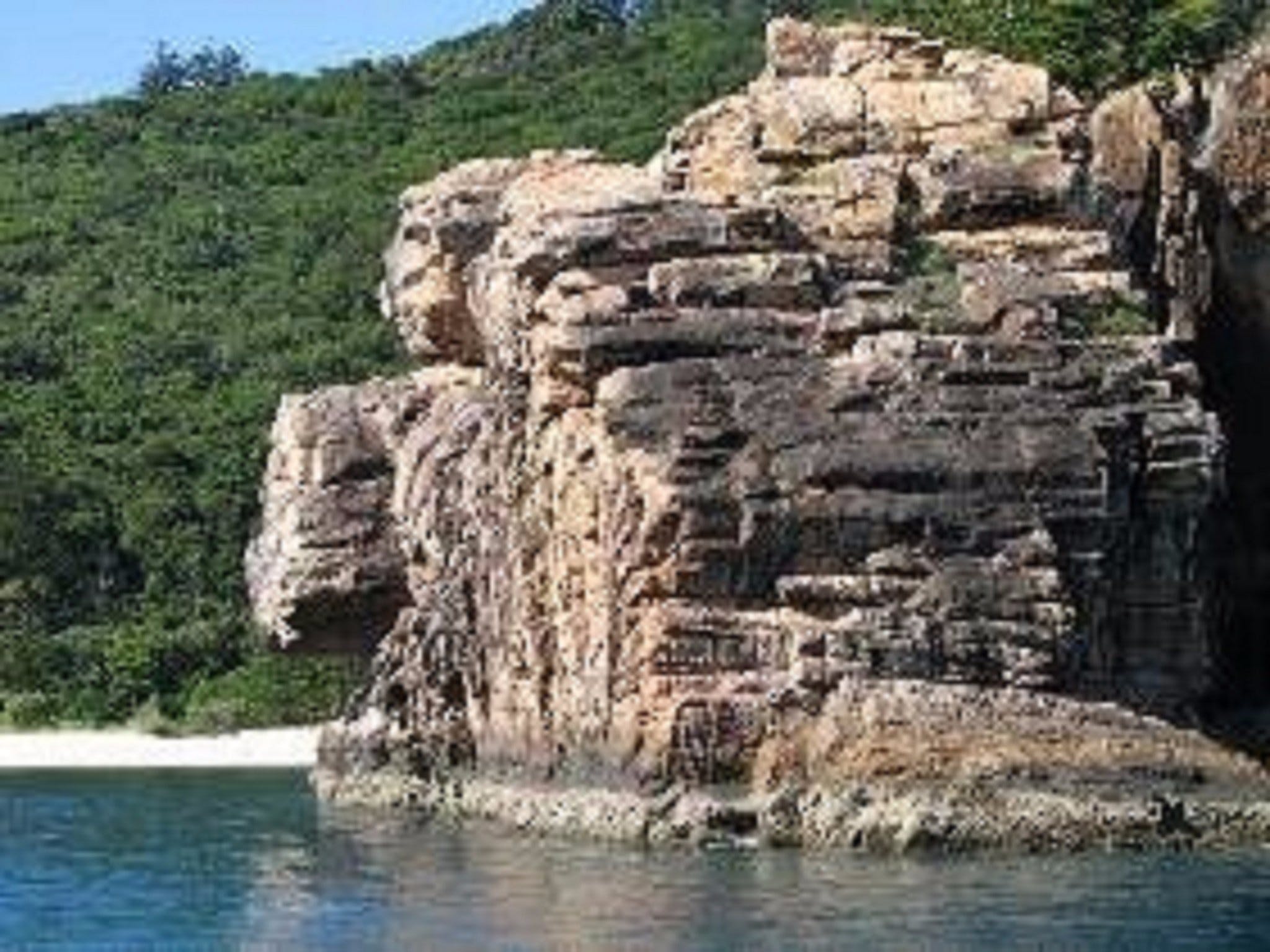
Capricorn Coast National Park has four separate accessible sections that can be enjoyed in a 30 minute drive between Yeppoon and Emu Park. Mangroves, dry rainforest, tussock grassland and open eucalypt forest provide a wonderful contrast to the blue waters of Keppel Bay. Rocky outcrops along the Capricorn Coast are the result of violent volcanic eruptions millions of years ago. Enjoy a beachside picnic at Bluff Point day-use area and take the 2.3 kilometre walking track for fabulous views over islands and hinterland. Watch sea turtles from the high cliffs of Turtle lookout. Explore Double Head along a sealed 365 metre walking track and visit Fan Rock lookout, a fan-shaped cliff formation with hexagonal basalt columns. ...
Devils Thumb (Manjal Jimalji) Trail Logo and Images

Devils Thumb (Manjal Jimalji) Trail

Karnak Road, Whyanbeel QLD 4873
Located in the Mossman Gorge, Daintree National Park, the Devils Thumb (Manjal Jimalji) trail begins at Little Falls Creek. This challenging trail provides an opportunity for explorers to discover the unique vegetation of the upland and lowland rainforest, as well as the amazing range of bird life native to the region. Manjal Jimalji is the Eastern Kuku Yalanji place name for the locally known Devils Thumb and is a significant cultural site that tells the story of fire creation. On a clear day, hikers can enjoy stunning views of the coastline from the lookout. The trail requires a decent level of fitness – so be prepared for steep ascents and slippery surfaces. The trail is broken up into sections identified by natural landmarks and distance markers have been placed at one kilometre intervals along the route to help you track your progress....
Wongi State Forest Logo and Images

Wongi State Forest

Wongi Waterholes Camp Area Road, Duckinwilla QLD 4650
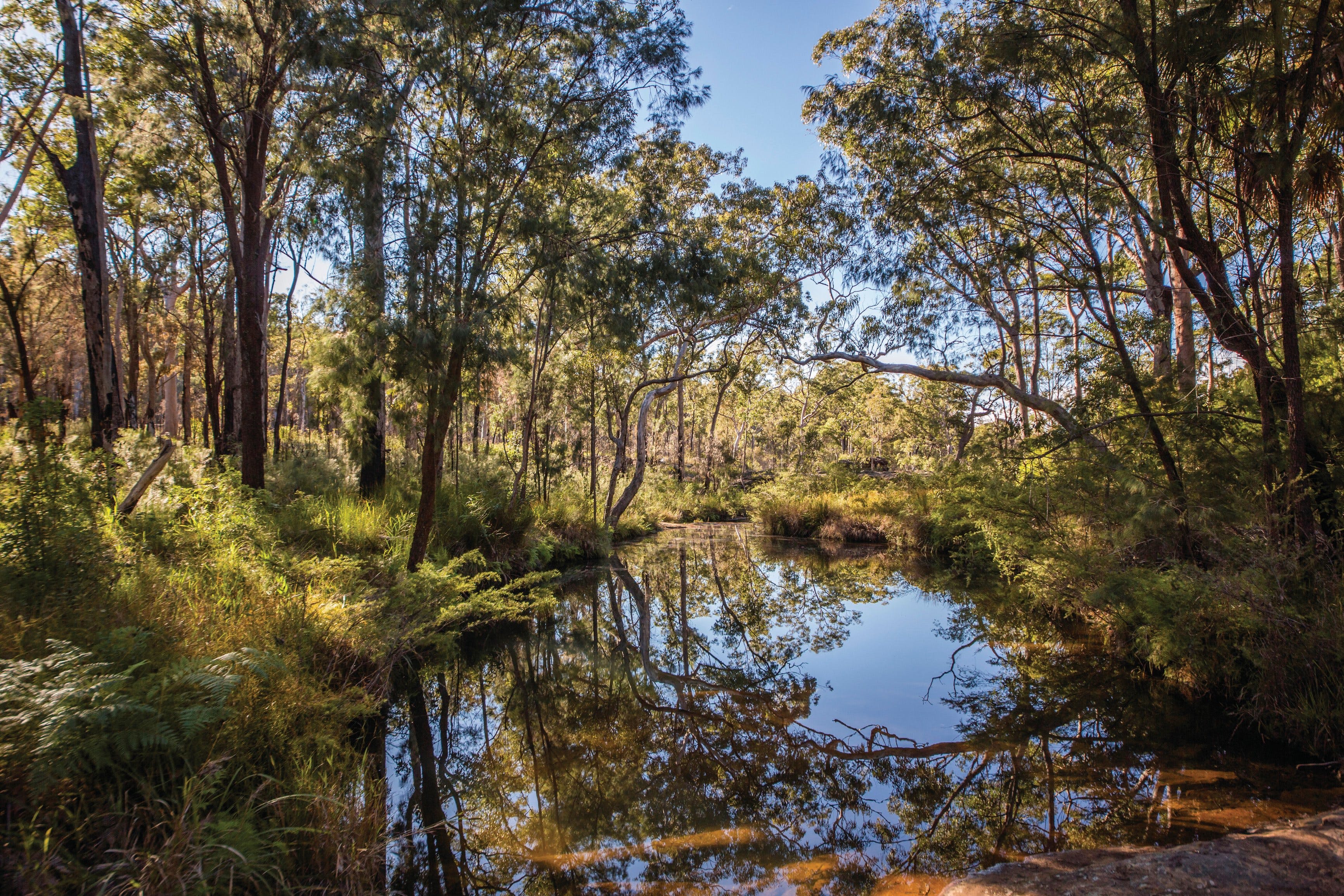
Immerse yourself in a landscape of fragrant pine plantations and eucalypt forests surrounding a string of beautiful waterholes, fringed by paperbarks and rushes in Wongi State Forest. A photographer's dream, the tannins from the paperbarks have coloured the waterholes a golden-brown, creating striking reflections. Forest communities include hoop pine dominated rainforest, open eucalypt forest, and open woodland with a heath understorey. Exotic pine plantations are also grown here. In the heart of the forest is Lenthalls Dam, the water supply for Fraser Coast Regional Council. Ride your horse on the National Bicentennial Trail which passes through the forest. Dogs are also permitted in Wongi State Forest—they must be on a leash and under control at all times. Camp or picnic amongst the eucalypt forest near the edges of Wongi Waterholes. Set up camp or park your van in the shade and spend the morning birdwatching along the bank. Enjoy a picnic by the cool water or explore the tranquil waters by canoe. Image credits: © Queensland Government...
Eurimbula National Park Logo and Images

Eurimbula National Park

42927 - Agnes Water QLD 4677
Discover Eurimbula National Park's unique blend of landscapes—mangrove-fringed estuaries, freshwater paperbark swamps, lowland eucalypt woodlands, and tall rainforest with towering hoop pines. The park is a paradise for bushwalkers, boaties and anglers. Stroll along wide, sandy island beaches with rugged boulders and delicate rock pools or wander through colourful wildflowers in spring, looking for red-tailed black-cockatoos and brolgas in the woodlands. The 360 metre walking track to Ganoonga Noonga lookout offers spectacular views over the coastal lowlands. At high tide, explore Eurimbula Creek by boat or canoe. Paddle along tranquil coastal waterways and creeks on the Eurimbula sea trail, where cormorants and white-bellied sea-eagles are often spotted along the shore. Spend a night on your own island paradise, choosing from one of five serene beach camps. Cast a line from the nearby beaches or creeks to catch your own dinner, then recline beneath the starry sky and enjoy true peace and quiet. Camping permits are required and fees apply. Image credits: Cathy Gatley © Queensland Government. ...
Iningai Nature Reserve Logo and Images

Iningai Nature Reserve

- Jundah Road, Longreach QLD 4730
Iningai Nature Reserve is named after the Inangai, the traditional owners who lived along the Thomson River prior to European settlement. It is currently a reserve and the town common. You'll find bushwalking tracks leading from just south of town where car parking is available. The many different walks and loops make an enjoyable expedition and showcase much of the local flora and fauna....
Eubenangee Swamp National Park Logo and Images

Eubenangee Swamp National Park

Cartwright Road, Babinda QLD 4861
Eubenangee Swamp, an important wetland in the coastal lowlands between Ingham and Cairns, is a birdwatchers' paradise. Over 190 species of birds have been recorded here. Sitting below the Bellenden Ker Range (the wettest part of Australia), much of this park is flooded during the wet season. As well as being a significant habitat for waterbirds, and crocodiles, the park also protects some of the last remnants of various lowland vegetation types. Stroll along the 1.5 kilometre return walking track that follows the Alice River, through rainforest to the top of a grassy hill and enjoy views of Bartle Frere and Bellenden Ker, Queensland's two highest peaks, as well as the swamp and its many waterbirds. Remember to be croc wise. Image credits: Qld Govt....
Whale Watching on Keswick Island Logo and Images

Whale Watching on Keswick Island

43192 - Keswick Island QLD 4741
Humpback Whales can be frequently seen around Keswick Island during their annual migration through the Whitsundays between the months of July to September. Seeing the whales frolicking nearby, or guiding a newborn calf through the protected waters of Egremont Passage, is a truly magical experience. There are many spots on Keswick from which you can watch the whales - be it from the deck of the Keswick Kiosk, from Basil Bay beach or from any of the prominent headlands. If you are watching whales from your boat, be sure to comply with the Australian National Guidelines for Whale and Dolphin Watching....
Daisy Hill Koala Centre Logo and Images

Daisy Hill Koala Centre

Koala Centre, Daisy Hill QLD 4127
***Please Note: In response to COVID-19, the Queensland Government is taking proactive steps to reduce potential risks to vulnerable people in the community. As a result, Daisy Hill Koala Centre is closed until further notice. They apologise for any inconvenience.*** Visit Daisy Hill Koala Centre to see koalas in a natural outdoor setting. Come and be captivated by these amazing marsupials and discover more about the secret life of koalas. Admission is free. You can see the resident koalas from two different viewing levels so don't forget your camera. Visitors are unable to handle or pat the koalas. Discover the secret world of koalas! Learn more about koalas by exploring the fun and informative displays in the centre. Watch short films in the Woodland Theatre, discover all about the koala's life cycle and unique biology, learn the signs and symptoms of a sick or injured koala, learn how you can contribute to the conservation of koalas, find out what the Queensland Government is doing to help koalas, learn about other interesting Queensland wildlife species. The centre is wheelchair accessible....
Lochern National Park Logo and Images

Lochern National Park

Tonkoro Road, Longreach QLD 4730
This is Queensland’s channel country, where flooding rains and devastating droughts are part of western Queensland life. Lochern has 20 kilometres of Thomson River frontage, fringed with huge old coolibahs. All four species of Mitchell grass grow here. A newly described subspecies of turtle, Emmott’s short-necked turtle, lives in the park’s waterholes. Remnants of European history reflect the innovative nature of early farming life. Take binoculars to see Major Mitchell cockatoos, red-tailed black-cockatoos and Bourke parrots. Observe wildlife around waterholes and along the 40 kilometre Habitat Drive. Go fishing (size and bag limits apply). Camp at Broadwater Waterhole, camping fees apply, and relax in the shade of the coolibah trees. See the shepherds’ yards....
Mount Beerwah Logo and Images

Mount Beerwah

43340 - Glass House Mountains QLD 4518
Mount Beerwah is the highest of the 10 volcanic plugs that make up the Glass House Mountains. It has two peaks, the taller of which is 556 metres high making it one of the most visually prominent mountains in south-east Queensland. The north face of the mountain features a dramatic, inward leaning cliff face known as the Organ Pipes. At its base are a number of small caves. Only fit and experienced climbers should attempt to reach the summit. It’s a 2.6 kilometre return journey and it will take at least three to four hours. Climbers should plan on taking at least two to three litres of water per person for the journey. Always take another person with you and make sure you let people know where you’re going and what time they can expect you back. Access the climbing trail via the picnic area. The route takes you through wet eucalypt forest before opening up into heath, dotted with grass trees and banksias, as you climb towards the summit. At the summit you are rewarded with stunning 360 degree views of the coast, other Glass House peaks and the D’Aguilar Range to the west....
Djiru National Park Logo and Images

Djiru National Park

Tully- Road, Mission Beach QLD 4852
Djiru National Park, near Mission Beach, protects some of the last remaining lowland rainforest in the Wet Tropics, including a rare patch of Licuala fan palm forest. It is also one of the few places you're likely to see the endangered southern cassowary. Enjoy a barbecue at Lacey Creek day-use area and learn about cassowaries at the information shelter. Stroll along the short circuit walk through the forest and past a viewing platform overlooking the creek. Take a picnic to Licuala day-use area and follow the children's cassowary walk. Amble along the longer circuit walk that leads you under the bright green, patterned canopy of Licuala fan palms. Keep a lookout for cassowaries and always 'Be Cass-o-wary!'...
Undara Experience Logo and Images

Undara Experience

Undara Volcanic National Park, Mount Surprise QLD 4871
Only three and a half hours from Cairns in Tropical North Queensland's Gulf Savannah lies a land so different in contrasts - the Undara Volcanic National Park. Undara is a pristine wilderness possessing one of the oldest and best preserved lava tube systems anywhere on Earth. Undara Experience presents unique railway carriage accommodation, pool, resort kiosk and many activities including Savannah Guide escorted tours to the incredible Undara Lava Tubes, Wildlife at Sunset tours and campfire evenings. It is also the home of Undara Outback Rock and Blues & the Rockabilly Rods and Rides Festivals. Undara Experience boasts superb cuisine, which can be enjoyed within nostalgic dining carriages. Relax in the bar as the burnt oranges of the sunset fade into dark to reveal the clearest starlit night. Each morning you can enjoy a true Bush Breakfast completely surrounded by native Wildlife. The Wildlife at Sunset tour is a sight not to be missed. Enjoy refreshments as the sun sets then, as dusk settles, a visit to the entrance of Barker's Tube allows you to witness the amazing emergence of literally thousands of Micro-bats as they leave to feed for the night - most spectacular in the Summer Green Season....
Blackdown Tableland National Park Logo and Images

Blackdown Tableland National Park

Charlevue Road, Dingo QLD 4702
Discover ancient Aboriginal art, deep gorges and scenic waterfalls in Blackdown Tableland National Park, traditional home of the Ghungalu Aboriginal people. Explore several walking tracks through the park and encounter the unusual plant communities that thrive in the cooler, elevated climate. Catch your breath from scenic lookouts and be amazed by ancient relics from the past. Pitch your tent in Munall camping area for a night or two. Take your torch into the bush to see some of the region's nocturnal birds and animals. Discover plants and animals that are found nowhere else including Blackdown stringybark, red bottlebrush, the Blackdown 'monster' (an underground cricket) and a Christmas beetle. Remember to book your camp site well in advance if you're planning your trip during school holidays....
Numinbah Section, Springbrook National Park Logo and Images

Numinbah Section, Springbrook National Park

Nerang Murwillumbah Road and Chesters Road, Numinbah Valley QLD 4211
Experience spectacular waterfalls, lush rainforest, ancient trees, impressive views and exceptional natural beauty in the Numinbah section of Springbrook National Park. Located in the foothills of the famously beautiful south-east Queensland’s Border Ranges, this park protects an area of great ecological importance and is part of the Gondwana Rainforests of Australia World Heritage Area. Numinbah is on the western side of the Springbrook plateau. The rugged mountain scenery makes this a superb area for photography. Take time to relax and unwind in the cool mountain air and soak up the . Relax on the banks of the Nerang River in the shady Forest Park day-use area, a perfect spot for a barbecue or picnic. A diverse array of water-dwelling animals live in the park including many species of frogs, as well as blue spiny crayfish and eels. If you are lucky you may even catch a glimpse of a platypus in the river....
Green Island National Park Logo and Images

Green Island National Park

27 kilometres east of Cairns, Green Island QLD 4871
This small rainforest-clad coral cay is surrounded by coral reefs and is one of the Great Barrier Reef's most popular destinations. A true coral cay, it was formed over thousands of years by the build-up of sand and coral rubble deposited on the calm side of a platform reef. Tropical vine forest covers the island. Palm-fringed sandy beaches slope gently to the clear, blue-green waters of the surrounding reef, which is within the Great Barrier Reef World Heritage Area. Stroll around the island's boardwalks to explore the rainforest and birdlife and find out about the island's colourful history. Walk around the island's beaches to view seabirds and enjoy views over the reef. Relax on the beach and listen to the birds in the forest behind you. Take a break from the beach and picnic on tables placed in the cool shade of the forest. Swim or snorkel or paddle a kayak in the clear reef waters. Go for a ride in a glass-bottomed boat or join a guided nature walk. Visit Marineland Melanesia Crocodile Habitat....
Smalleys Beach Logo and Images

Smalleys Beach

Smalley's Beach Road, Cape Hillsborough QLD 4740
Smalleys Beach is situated approximately 35 kilometres north of Mackay and is part of the Hibiscus Coast. This secluded beach is also located in the Cape Hillsborough National Park and offers limited camping sites. Facilities include toilets, and small secluded sites. Water must be brought with you. Camping is by self registration. A gravel road can be accessed from Cape Hillsborough Road to Smalleys Beach to camping sites. Camping sites have great access to the picturesque beach and walking trails. ...
Neurum Creek Campgrounds Logo and Images

Neurum Creek Campgrounds

Neurum Creek Camping Area, Stony Creek QLD 4514
Nestled in eucalypt woodland, Neurum Creek Camping grounds is located on the eastern side of Mount Mee, in D’Aguilar National Park. Off grid compared to other local spots, with thirteen allocated sites, these campgrounds are only accessible by 4WD via the turn off from Neurum Creek Road. RV’s and camper trailers are prohibited at Neurum Creek Campgrounds, making it a swag, tent, roof top or slide on 4WD camper only. Each of the thirteen camp sites at Neurum Creek has a single allocated parking spot, fire pit and access to a water tap with rainwater. Firewood is not provided and chopping wood in the National Park is prohibited, so bring your own supply....
Mossman Gorge Centre Logo and Images

Mossman Gorge Centre

212R Gorge Road, Mossman QLD 4873
Visit Mossman Gorge and experience the Daintree World Heritage Rainforest with pristine waterfalls, mountains and vivid flora and fauna, all the while getting lost in its enchanting stories and rich Indigenous heritage. Begin your trip by paying a visit to the Mossman Gorge Centre. Peruse the Indigenous art work, enjoy a light refreshment at Mayi café and book yourself onto one of the award-winning Ngadiku Dreamtime Walks, The walks are conducted by the traditional owners of the Gorge, the Kuku Yalanji people. Be taken on a journey steeped in heritage as you uncover their ancient culture and traditions. After a visit to the Centre, a shuttle bus will transport you into the heart of the Gorge where the adventure begins through this unique wilderness. Whether at your own pace on one of the self guided walks through the National Park or with an expert local indigenous guide on the Dreamtime Walks the Gorge is guaranteed to leave you enthused and inspired. ...
Castle Hill Blackstone Reserve Logo and Images

Castle Hill Blackstone Reserve

7 Mary Street, Blackstone QLD 4304
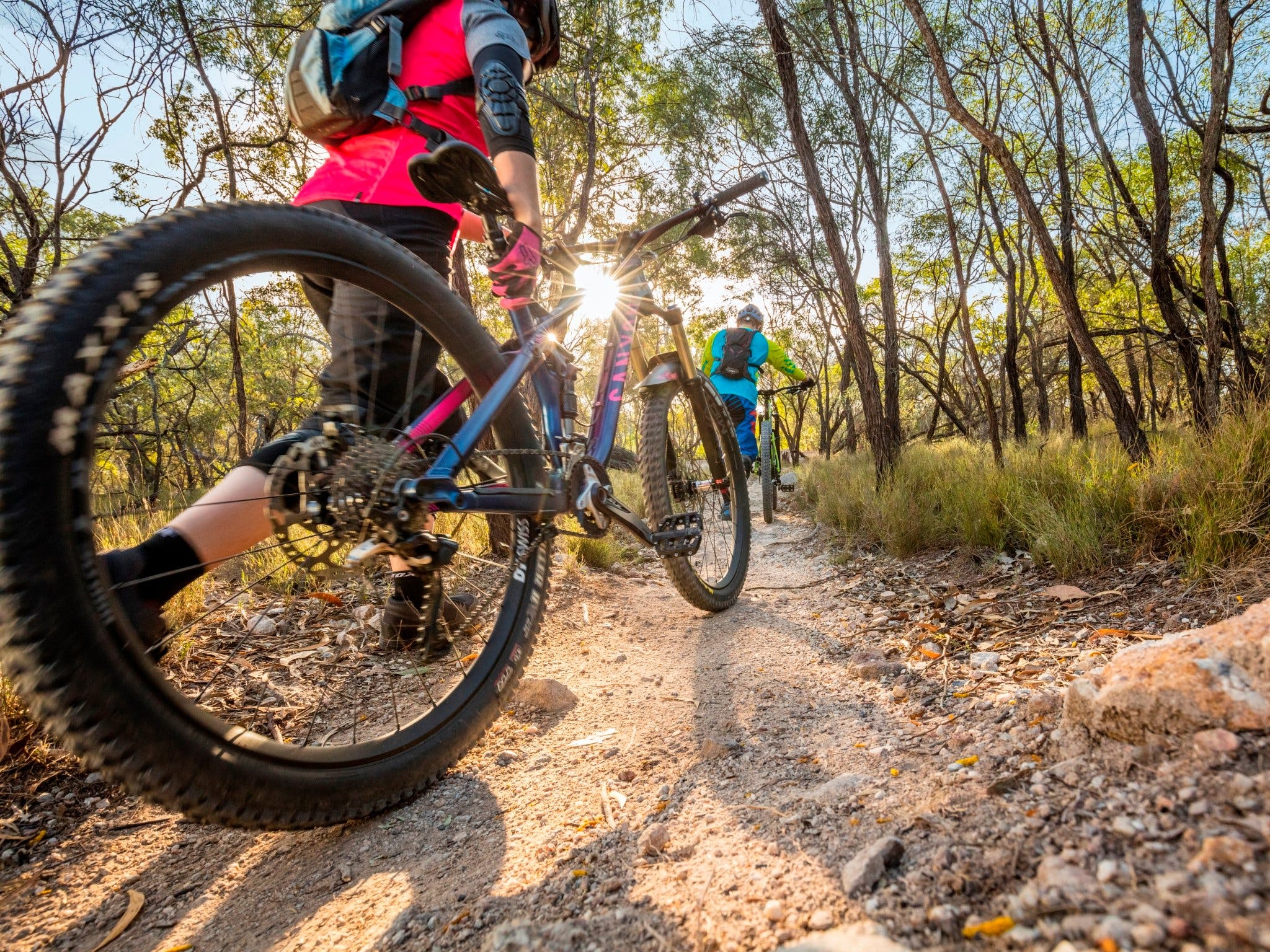
From culture-rich mining heritage to adrenalin-fuelled downhill mountain biking, Castle Hill is a unique place and offers an experience unlike anything else in the region. With over 15 International Mountain Biking Association rated mountain bike trails ranging from easy to very difficult, Castle Hill is suitable for riders of all abilities and is cemented as an iconic riding destination in Ipswich. Castle Hill caters for all levels of mountain bike riders, but is best known for its technical single trails which can challenge even experienced riders. Mountain bikers can choose a ride to suit their fitness, ability and time available. Although the distances are not long, the hilly terrain and style of trails means that you have to work for every kilometre of your ride. Riders can choose from trails like the gently rolling Blackleg Gully Circuit up to the more advanced rollercoaster-style trail, the Inca. For those wanting to discover the Reserves historical significance, take a walk along the Lewis Thomas Historical Trail. Explore the coal mining history of the reserve as you pass open mine tunnels, hand-dug mine shafts and relics of the imposing three storey “Castle” which once towered over Blackstone. ...
Cleveland Point Reserve Logo and Images

Cleveland Point Reserve

Point Reserve, Cleveland QLD 4163
Visitors to Cleveland Point Reserve could be forgiven for thinking they had landed on an island paradise. With magnificent Moreton Bay on three sides, Cleveland Point is one of many must-visit sites on Redlands Coast. The reserve is family-friendly with a park, children’s playground, shaded picnic areas and toilets – and it even has a link to the city’s historic past with its own lighthouse, a Redlands Coast and South East Queensland icon. With a road that takes you to Cleveland Point looping around the whole park, you don’t even have to leave your car. But there are plenty of reasons to stop and stay a while. The Lighthouse restaurant and attached fish and chippery serves up great seafood and other fare to either eat in or take away and enjoy at one of the many picnic tables available. Why not try a coffee and cake or drink from the café as you gaze across the bay to North Stradbroke Island. Visit Cleveland Point and you will understand why movie makers chose to shoot the third movie of the hit Narnia series – the Voyage of the Dawn Treader – there. This picturesque family park is definitely worth checking out. ...
Woodgate Beach Park and Playground Logo and Images

Woodgate Beach Park and Playground

164 Esplanade woodgate, Woodgate QLD 4660
Woodgate Beach boasts 16 kilometres of white sandy beaches surrounded by 20,000 hectares of National Park. The Woodgate Beach Park and Playground is located on the waterfront offering stunning views of the coastline. Woodgate Beach is situated 38 kilometres of the Bruce Highway along Goodwood and Woodgate Roads (all bitumen). You will find prolific numbers of birds including emus, brolgas and jabiru together with kangaroos, wallabies, echidnas, possums and reptiles which all inhabit the National Park and surrounding areas. Unwind, relax and enjoy a natural experience at Woodgate Beach....
Capricornia Cays National Park Logo and Images

Capricornia Cays National Park

Capricornia Cays, Gladstone QLD 4680
Capricornia Cays’ stunning white beaches and coral reefs will leave a lasting impression. Their exceptional beauty and biological diversity make them internationally significant. Capricornia Cays National Park protects eight coral cays which rise just a few metres above the high tide mark - Lady Musgrave, North West, Masthead, Wilson, Heron, Erskine and Tryon islands and Broomfield Cay. Their biological diversity, exceptional beauty and the endangered plants and animals they protect make them internationally significant. The cays support the largest breeding population of endangered loggerhead turtles in the South Pacific. A large percentage of the Great Barrier Reef's seabird species visit each year to nest. Go reef-walking, snorkelling, diving, birdwatching, boating or fishing. You can camp on two of the eight islands. Camping fees apply and bookings are essential. Book well in advance for school holidays. Take water and a fuel stove. Seasonal closures protect breeding seabirds, turtles and vegetation. Access to Tryon Island is restricted. Check restrictions on activities such as spearfishing, anchoring, fishing and collecting....
Butterfly Bay - Hook Island Logo and Images

Butterfly Bay - Hook Island

East of Alcyonaria Point, Hook Island QLD 4741
A popular bareboat anchorage, Butterfly Bay is situated on the northern side of Hook Island. There are limited public moorings and snorkelling can be enjoyed along the bay edge or just off the beach. Offering coral outcrops with shallow walls, the bay is populated by many small, colourful reef fish species. The best of the bommies is found in the centre of the bay, although it may be difficult to locate at high tide. Be wary of tidal currents when moving towards the centre of the bay, away from the edges. Visibility: 2 - 10 metres. Diving depth: 5 - 12 metres. Bottom: coral cover with large patches of coral rubble and silty sand....
The Pinnacles Logo and Images

The Pinnacles

44253 - Hook Island QLD 4741
Arguably the best dive site in the Whitsundays, with hard corals comparing favourably to those seen on the outer Great Barrier Reef. The best dive is off the western beach, adjacent to the Woodpile and swim east at a depth of seven to 15 metres. Large coral bommies dominate the terrain, reaching nearly to the surface. Acropora corals are everywhere and huge porite corals in the shape of boulders and massive towers can also be seen. Manta rays are very common in the cooler months, May to September, as are big Maori Wrasse. This dive is not for the faint-hearted as black and white tip reef sharks are frequently seen! In the shallow water, particularly off the western beach, the coral cover is nearly solid, mostly staghorn, with only a few sandy patches. Excellent snorkelling just off the western beach too. Diving depth is three to 18 metres. Diving visibility is typically three to 15 metres....
Inskip Peninsula Recreation Area Logo and Images

Inskip Peninsula Recreation Area

Inskip Peninsula Recreation Area, Rainbow Beach QLD 4581
Inskip Peninsula is a narrow, sandy finger of land built up by wind and waves, forming a natural breakwater at the entrance to Tin Can Inlet and Great Sandy Strait. Close to Rainbow Beach, Inskip is a gateway to World Heritage-listed Fraser Island. Beach she oaks, cypress pine and other coastal trees and shrubs shade the very popular camping areas ringed by open ocean beaches and sheltered estuary shores. Tin Can Bay is a wetland of international importance. The sand spit is clad in casuarina, cypress pine and other coastal vegetation, providing a great habitat for birds. The beaches and mudflats are roosts for waders and thousands of resident and migratory shorebirds. Bring your own drinking water and camp in one of four shady camping areas. Dogs are permitted in the recreation area, but must be kept on a leash at all times. Bring your binoculars to view birds in the early morning or late afternoon. Look for button-quail on the sandy tracks and shorebirds (in summer). Watch for dugong, turtles and dolphins in the bay. You must bring your own firewood for campfires, but best to bring a fuel or gas stove and reduce your use of campfires....
Lake Eacham, Crater Lakes National Park Logo and Images

Lake Eacham, Crater Lakes National Park

Road, Lake Eacham QLD 4884
Please note: In response to COVID-19, the visitor centre at the Lake Eacham nursery in Crater Lakes National Park is closed until further notice. A serene blue lake surrounded by lush tropical rainforest, Lake Eacham is part of Crater Lakes National Park. Take a refreshing dip and then relax in the shade, or wander along the viewing decks for uninterrupted water views. The lake is a maar—a volcanic crater formed by massive explosions from the superheating of groundwater. The crater has filled with water, forming a lake 65m deep. Stroll around the 3km track encircling the crater lake for forest-fringed views of the lake . You'll be surrounded by birdsong as the lake's birds call, twitter, screech and sing from the treetops. Over 180 bird species have been recorded from the rainforest. Look for musky rat-kangaroos—these small, chocolate-coloured macropods are often seen during the day. Learn about the rainforest and animals as you wriggle like a snake, search for dragons and create amazing creatures on the fun active Children's walk. Paddle a kayak or canoe on the smooth waters of the lake, keeping an eye out below for curious turtles and schools of fish....
Murray Falls, Girramay National Park Logo and Images

Murray Falls, Girramay National Park

Murray Falls Road, Murray Upper QLD 4854
Murray Falls, within Girramay National Park, is one of north Queensland's prettiest waterfalls, with large volumes of water racing over naturally sculpted granite boulders. Rainforested mountains and tropical lowlands meet in the attractive foothills of the Kirrama Range. The clear waters of the Murray River cascade over boulders into rock pools in this picturesque spot, within the Wet Tropics World Heritage Area. Enjoy a picnic in the grassy and shaded day-use area by the river. Stroll along the boardwalk to a viewing platform near the falls. For the more adventurous, take moderately graded 1.8 kilometre return walk through a cool rainforest gully, and then up into open forest and spectacular views over the falls and Murray Valley. Look for wallabies, possums and a variety of reptiles. Bring binoculars and watch for many colourful birds. Enjoy colourful wildflower displays in spring. Access the river from the day-use area but take care as the water is often fast flowing and the rocks slippery, however access to the river upstream of the day-use area is not permitted. Slippery rocks make it dangerous and serious injuries have occurred. Image credits: Lookout (Qld Govt); Falls (TEQ)...
Princess Hills, Girringun National Park Logo and Images

Princess Hills, Girringun National Park

Wairuna Road, Minnamoolka QLD 4872
Princess Hills, Girringun National Park boasts spectacular scenery and an array of plant and animal life. The impressive Herbert River Gorge featuring towering cliffs and dry, rugged ridges, begins at the base of the Herbert River falls. Open forest dominates the escarpments, and she-oaks line the Herbert River. Vine-thicket rainforest dotted with hoop pines cloaks the gullies and upper slopes of the gorge. The air around the camping area often smells of lemon-scented gums. There are no formal walking tracks at Princess Hills but you can walk alongside the Herbert River. Look for freshwater crocodiles and turtles basking in the sun, and see how many species of fish you can identify. By day keep your eyes open for emus and a variety of other birds, as well as the occasional koala. The camping area is beside the Herbert River, four kilometres from the top of the spectacular Herbert River Falls. Stay overnight in shady camp sites and listen for gliders and owls, which dominate the night sounds of Princess Hills. Image credits: James Altafer, Qld Govt....
Cedar Creek Falls Logo and Images

Cedar Creek Falls

Conway Road, Proserpine QLD 4800
You will find Cedar Creek Falls about half way between Airlie Beach and Proserpine on Saltwater Creek Road. Set in a natural rock amphitheatre, you will enjoy spectacular waterfalls in the wet season and abundant flora and fauna including majestic white cedar trees, Alexandra Palms, wild orchids, colourful butterflies and many beautiful birds. The waterhole is an easy walk from the parking area and there are also bush walks up and around the falls for the more energetic. Share the cool, clear waters of the rock pool with fish, turtles, lizards and maybe a few other humans. Do: Take towel, bathers, hat, walking shoes, water, sunscreen and insect repellent. Do not: For your own safety jumping and diving from the waterfall is strictly prohibited. ...
Cape Pallarenda Conservation Park Logo and Images

Cape Pallarenda Conservation Park

Cape Pallarenda Road, Townsville QLD 4810
Cape Pallarenda Conservation Park was a quarantine station in the early 1900s and a strategic defence location in World War II. Nestled in a scenic coastal location amongst open woodland and vine thickets, the historic quarantine station, established in 1915, was initially used to quarantine passengers on incoming ships. During World War II the area became a strategic defence location. Concrete structures were built on the headland in 1943 to protect Townsville and the harbour from raiding enemy ships. American and Australian armies set up camps on nearby beaches and used the Quarantine Station as a hospital. Spend time in the station's historic display centre to find out more about the quarantine days. Then set off on foot or by mountain bike to explore the shared Cape Pallarenda Trails to enjoy scenic coastal views and discover the historic World War II structures on Cape Pallarenda headland. Choose from short strolls to longer hikes or rides around the slopes of Many Peak Range. Explore picturesque beaches and forested slopes of Many Peak Range. Enjoy a picnic on the foreshore. Look for wallabies, lizards and many kinds of birds in the woodland....
Hillview Drive Reserve Logo and Images

Hillview Drive Reserve

4 Leslie Drive, Muirlea QLD 4306
Hillview Drive Reserve features 37.2 hectares of undulating bushland just 4.7 kilometres north of the Ipswich Central Business District. The reserve boasts a variety of forest vegetation and abundant wildlife. Part of a recreational trail network spread across four nature estates in the region, the professionally built dual-direction, low-impact shared-use recreational trail is ideal for walking, hiking, birdwatching and mountain biking. Hillview is well-appointed with interpretive signage and a shelter and picnic table make for the perfect tranquil lunch surrounded by natural beauty. The hillside leads down to a creek line flowing into the Brisbane River through Kholo Botanic Gardens, where public toilets and drinking water are available. ...
Lake Wabby Logo and Images

Lake Wabby

Lake Wabby, Fraser Island QLD 4581
Lake Wabby is relatively close to the ocean side of Fraser Island and unlike the other lakes, it supports several varieties of fish. It is known as both a window lake and a barrage lake. Window lakes form when the ground level falls below the water table. Barrage lakes form when a sand blow blocks the waters of a natural spring. This phenomenon is easy to see at Lake Wabby. On one side its deep green waters are bordered by a giant sand dune that is slowly moving into the lake. In a century or so, the sand dune's inexorable march westward across Fraser Island will see it completely swallow the lake. Lake Wabby is a popular spot for those exploring the numerous sand dunes on World Heritage Listed, Fraser Island. ...
Langford Island Logo and Images

Langford Island

Langford Island, Whitsundays QLD 4802
Langford Island, near Hayman Island in the northern Whitsundays is a popular spot with sailors, divers and snorkellers. Many of the bareboats and crewed sailing boats will anchor near Langford Island. Langford Island is relatively small, but features a long sand spit that all but disappears at high tide. This is an excellent spot for a picnic, sunbathing, swimming and snorkelling. The best diving is found on the north-western end of the beach where scattered bommies offer an interesting maze to explore and there are a few shallow walls at the eastern end of the island. The majority of fish life is small, but abundant. Expect reasonable protection from all but the strongest wind conditions and moderate tidal currents at all but slack tides. Snorkellers will enjoy the ability to snorkel straight off the length of the beach, with the best areas to explore being closest to the island....
Cape Hillsborough National Park Logo and Images

Cape Hillsborough National Park

Road, Cape Hillsborough QLD 4740
Cape Hillsborough National Park is one of the most striking and peaceful places on the Central Queensland coast. It's teeming with life and diverse habitats—from rainforest and eucalypts, to mangroves, beaches and rocky headlands. It's a brilliant place to hike, picnic, boat, fish, relax and explore. You'll need a few days to fully appreciate this magical part of the world so make Smalleys Beach camping area your home-away-from-home—it's just a stone's throw from the beach and walking tracks. Dense rainforest meets the ocean and fine sandy beaches fringe the Great Barrier Reef World Heritage Area. Make your way over the intricate stippled patterns created by sand bubbler crabs, and search tidal rock pools for sea creatures. Agile wallabies gather on the beach to search for food at sunrise and sundown. Grab your camera! This is a truly iconic Australian experience that you shouldn't miss. The Yuibera Aboriginal people lived in this country for many thousands of years before explorer James Cook named Cape Hillsborough in 1770. Visit The Diversity boardwalk and Yuibera plant trail to understand the Yuibera people's connection to this country, and their traditional way of life....
Edmund Kennedy, Girramay National Park Logo and Images

Edmund Kennedy, Girramay National Park

Clift Road, Cardwell QLD 4849
This scenic part of Girramay National Park features lowland rainforest, open eucalypt forest, paperbark woodland, sedge swamps and extensive mangrove forests as well as secluded beaches with island views. The park's swamps are flooded by wet season rains flowing from coastal ranges, and, as the flood waters subside, the swamps become a tranquil setting, the water stained with tannin from the tea-trees. This diverse wetland park is in the Wet Tropics World Heritage Area. Enjoy a relaxing stroll along the beach to the mouth of Wreck Creek (5 kilometre return). Birdwatch and have a picnic at Rockingham Bay day-use area with views of 13 offshore islands. Walk the newly-replaced boardwalk through a mangrove forest still recovering from a cyclone. Visit the Arthur Thorsborne Aboretum near the park entrance for a shady picnic and discover local rainforest plants along the short, wheelchair-accessible loop track. Image credits: Qld Govt...
Hardy Reef Logo and Images

Hardy Reef

Hardy Reef, Whitsundays QLD 4802
Hardy Reef, on the Great Barrier Reef off Airlie Beach, is home to the Reefworld Pontoon. There is spectacular fish life with Trevally, Coral Trout, Snapper and a host of smaller marine life as well as Giant Maori Wrasse and a two metre long Giant Queensland Groper that usually congregate for a free feed. Snorkelling is excellent, as is diving off nearby drop-offs where you'll find turtles, reef sharks and barracuda amongst a myriad of other intriguing reef species....
Kooroorinya Falls Nature Reserve Logo and Images

Kooroorinya Falls Nature Reserve

Prairie - Muttaburra Road, Hughenden QLD 4821
Kooroorinya Falls is a natural waterhole surrounded by high rock walls on one side and sandy, shaded banks on the other. Visitors can go swimming, fishing, birdwatching or just take a walk. There is a creek with plenty of water and spectacular falls during the wetter months. It is important to check road conditions before travelling during wet weather and to always carry plenty of water. Kooroorinya Campground is CLOSED until further notice. ...
Camooweal Caves National Park Logo and Images

Camooweal Caves National Park

-Urandangi Road, Camooweal QLD 4828
Wide expanses of Mitchell grass plains and spinifex woodland are protected in this park on the Barkly Tableland, a peaceful stopover for weary travellers and ideal for seasonal birdwatching. The park features caves and sinkholes that were formed when water percolated through 500 million year-old layers of soluble dolomite creating caverns linked by vertical shafts up to 75 metres deep. Relax and refresh at this pleasant stopover on the Barkly Highway. Take the short 70 metre return walk to the Little Nowranie Cave entrance or the 220 metre return track to the Great Nowranie Cave. Be extremely cautious around the edges of the sinkholes. The caves are not accessible to visitors. Camp in a remote bush setting at Nowranie Waterhole camping area. Look for a variety of birds including waterbirds and woodland species at different times of the year. Ride your mountain bike or trail bike on the park's internal roads and firebreaks....
Chillagoe-Mungana Caves National Park Logo and Images

Chillagoe-Mungana Caves National Park

Burke Developmental Road, Chillagoe QLD 4871
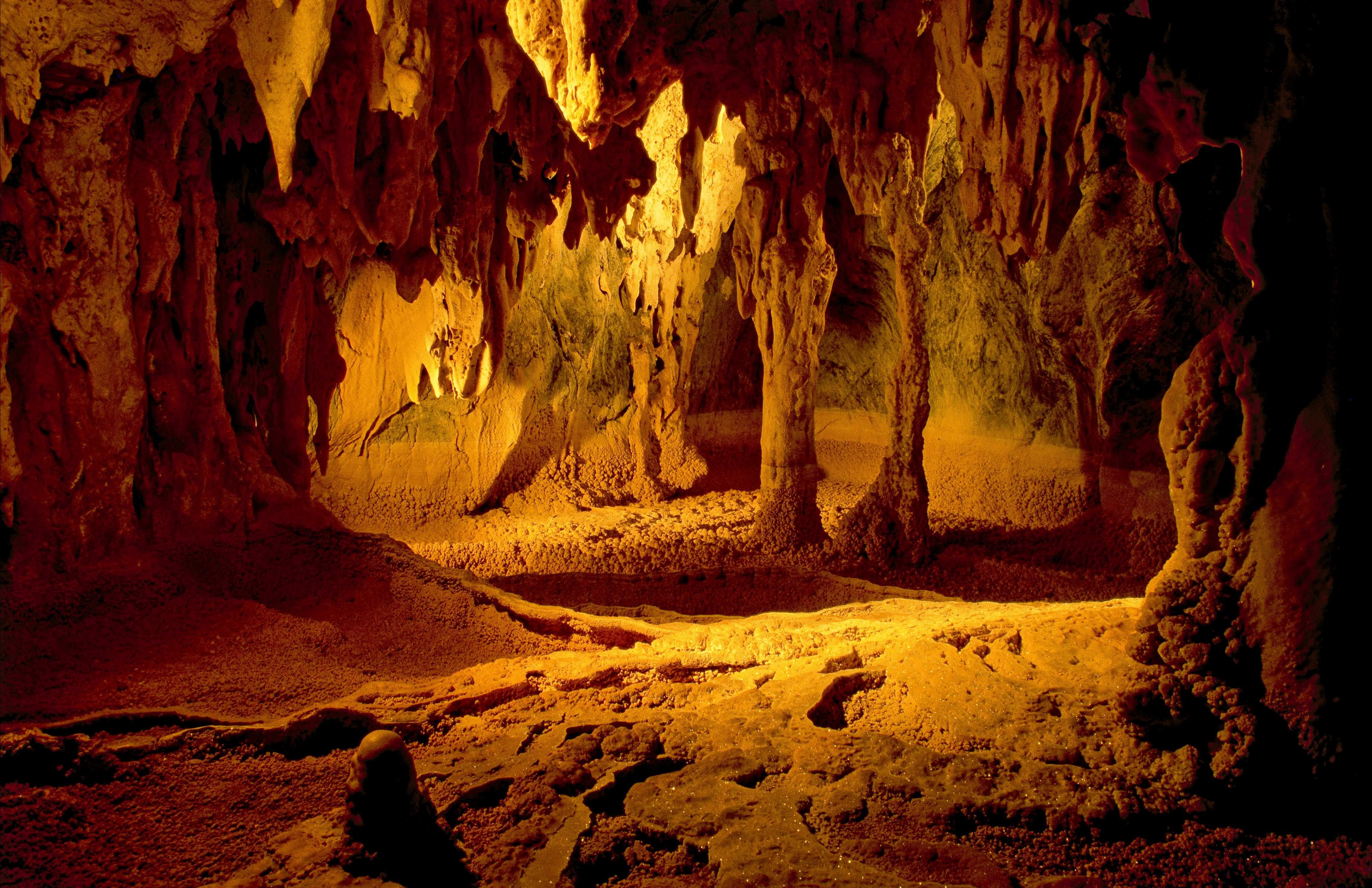
Featuring spectacular limestone caves, small galleries of Aboriginal rock art, jagged limestone outcrops and an historically significant mining site, this park is rich in natural and cultural heritage. The Chillagoe landscape began to form about 400 million years ago, when the area was covered by a shallow sea. Today that limestone towers over the surrounding plains as outcrops while underground, caves and caverns created by dissolving of the limestone are decorated by stalactites, stalagmites and flowstones. Join a ranger on a guided cave tour to view splendid limestone formations. Ranger-guided tours to Donna, Trezkinn and Royal Arch caves operate daily, except Christmas Day. If you are adventurous and well-prepared you can explore other caves and Aboriginal art sites on your own. Walk the nine kilometre return track to Royal Arch bluff or the short 440 metre return track to Balancing Rock. Visit the viewing area at the Chillagoe Smelters and learn about the State's mining and industrial heritage dating back to the 1890s....
Wairuna, Girringun National Park Logo and Images

Wairuna, Girringun National Park

Wairuna Road, Minnamoolka QLD 4872
Wairuna, in Girringun National Park, has a varied landscape of open forest and woodland on its western margin through to tall wet forest on the elevated range to the east. It features the headwaters of the Burdekin River, fed from high rainfall on the rugged ranges above Cardwell. Over times, the river carved out a wide plain, which now features abundant waterholes and lagoons that are seasonally full of water attracting a rich diversity of water birds. The traditional owners of the area are the Warrungnu Aboriginal people. The area also has a rich history of early European settlement by the Atkinson family including their work on Brahman cattle breeding and grazing. Camp overnight in one of three separate and partially shady sites beside the Burdekin River. Wairuna camping area is closed throughout the wet season from 1 December to 31 March inclusive. There are no formal walking tracks at Wairuna but you can walk alongside the Burdekin River. Look for freshwater crocodiles and turtles basking in the sun, and see how many species of fish you can identify. Many animals are most active around dawn and dusk and nocturnal mammals may be seen at night by spotlight....